New lasers for climate research
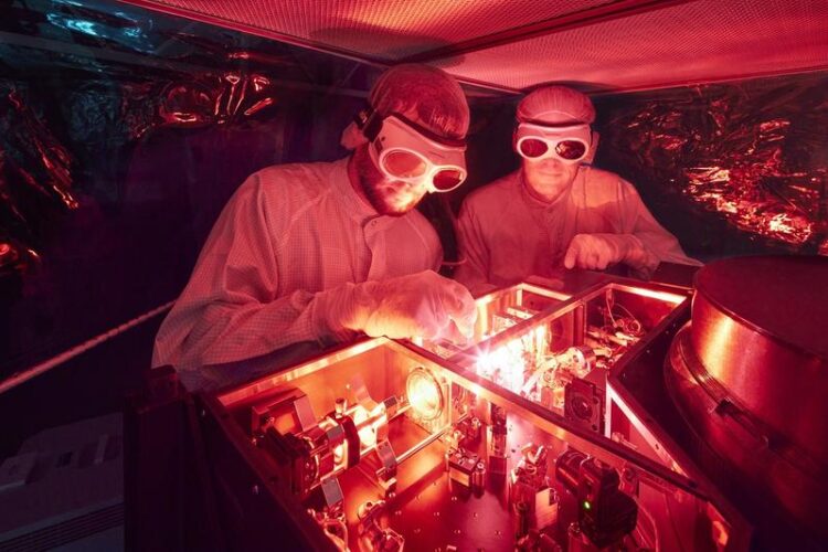
The alexandrite lasers have been optimized in the laboratory to such an extent that they can operate in the LIDAR systems for thousands of hours without maintenance or adjustment.
© Fraunhofer ILT, Aachen, Germany / Ralf Baumgarten
Weather reports, climate models or rocket launches – they all need precise data from the atmosphere. To acquire such data, scientists can use LIDAR (LIght Detection And Ranging) systems to shoot laser beams into the sky.
The backscattered light can be used to calculate wind and temperature data at altitudes of up to 100 km. A team from the Fraunhofer Institute for Laser Technology ILT and the Leibniz Institute for Atmospheric Physics IAP has developed a portable LIDAR system that works autonomously. In the future, such systems could be mass-produced and combined into networks to provide high quality climate data.
The view upwards
An October evening on the beach at the Baltic Sea: Although the water is amazingly clear, Josef Höffner chooses to look up. Where others see only sky and clouds, he sees a huge map opening up above him. “We don’t know much about the upper atmosphere in particular yet,” he comments. “There are still plenty of blank spots on the map.” Exploring these spots is his job – he’s an atmospheric physicist.
He has already traveled a lot with his research: He has traveled halfway around the world on the ship Polarstern for measurement campaigns, and has even been to Antarctica, to Spitsbergen and Andoya in northern Norway. “The polar regions are the most exciting for atmospheric research because that’s simply where you see the most.” When Josef Höffner is not traveling, he conducts research at the Leibniz Institute for Atmospheric Physics IAP in Kühlungsborn on the Baltic Sea. Perched on top of a knoll, the research buildings overlook the sea from the top of gentle hills.
At night, laser beams shine in the sky above the institute. “Sometimes, the local newspapers contact us because people suspect UFOs,” Höffner says, amused. “Yet these are just our LIDAR systems.” The researchers in Kühlungsborn have been using their LIDAR and radar systems since the mid-1990s, and now have several teams.
Does it get colder with altitude?
LIDAR systems send their beams through the atmosphere to heights of over 100 km. They essentially pass through three layers (Image 2): Troposphere (up to about 15 km altitude), Stratosphere (up to about 50 km) and Mesosphere (up to about 90 km). The height of the layers depends mainly on the solar radiation. However, the height also changes with the season or the geographical location.
The boundaries between the layers are defined by an intriguing phenomenon: Our experience tells us that temperature decreases with altitude. Between the layers, however, this reverses: In the stratosphere the temperature increases with altitude! Between strato- and mesosphere the temperature gradient reverses again, it gets colder. The layers where the temperature gradient reverses are called pauses, i.e. tropopause, stratopause and mesopause.
Josef Höffner is particularly interested in the uppermost layer, the mesosphere. The air pressure at its upper end is about one millionth of what humans are used to. Yet there are still plenty of particles at that altitude: “That’s the altitude where the nose of space shuttles starts to glow on re-entry.” The same is true for meteors: Many of them burn up in the mesosphere, leaving behind metal atoms that help atmospheric physicists enormously in their work.
“With the LIDAR laser, we excite these atoms in the atmosphere, for example, potassium or iron,” explains Höffner. The particles reflect the light back, albeit slightly altered; the physicist refers to this as scattering effects. The backscattered light is captured by telescopes in the LIDAR system on Earth. From the spectra, variables such as temperature and wind speed can be derived. The altitude results from the transit time of the laser pulses, the concentration of particles at altitude from the number of special photons.
What is happening in the ocean above us?
This roughly explains the tools of atmospheric physics, but what is there to measure up there? “A lot,” Höffner answers succinctly, “and we are discovering more and more.” To better understand the processes ‘up there,’ one can think of the atmosphere as an ocean. Like the ocean, there are waves, currents and tides. None of it simply disappears – every wave nudges another wave, leads to currents, as everything is in motion day and night. The boundaries between layers rise and fall, and layers influence each other. Which is why LIDAR measurements are very valuable for climate models and weather reports.
Unlike in the sea, however, the tides in the sky are caused by the sun: It heats the air on one side of the earth and the air rises, while it cools and sinks on the other side. Currents and waves exist in the same way: So-called gravity waves are particularly important for the exchange between the lower and upper atmosphere. They occur, for example, when a storm hits a mountain range. There, the air pushes upward, and the momentum continues far beyond the troposphere up into the mesosphere. The momentum from below pushes currents that can be measured over thousands of kilometers.
With LIDAR and radar systems, teams on the ground can accurately measure movements in the atmosphere. Balloons don’t get that high, and satellites provide only a snapshot as they fly overhead. Stationary LIDAR systems can measure currents along the laser beam upward virtually indefinitely. In the 1990s, Josef Höffner traveled around the world with a LIDAR system he developed for exactly this purpose at Leibniz IAP.
A new generation of lasers as a game changer
The system took up an entire shipping container. It weighed 10 tons and required 30 kW of electrical power to run. This in turn required tons of diesel in the generators on site. After all, it was the only semi-mobile system of its kind in the world, and it garnered scientific merits. However, it was too big, too heavy and required too much maintenance for greater use in the future.
That’s why Josef Höffner looked for new partners for laser development in the mid-2000s. He found them at the other end of Germany, at the Fraunhofer Institute for Laser Technology ILT in Aachen. There, they were familiar with the different types of lasers and also with the latest technology to make them smaller.
“An alexandrite ring laser, with radiation in the UV to boot, that was pretty special,” reports Michael Strotkamp, the current project manager at ILT. “Even our experts couldn’t just take it off the shelf.” At its core, the project involved replacing the laser’s energy source, the flash lamps, with laser diodes, a conversion that is about as simple as replacing a turbocharged gasoline engine with an electric motor. Accordingly, it took ten years from the first discussions to the first successful mesosphere measurement with the new diode-pumped alexandrite laser.
State-of-the-art laser technology
Alexandrite is a very special laser crystal: It can be tuned over a broad spectrum from 730 to 800 nm. Unlike titanium sapphire (a much better known laser crystal), it can also store abundant energy in the process. Thanks to these properties, it is particularly suitable for high pulse energies.
However, it must be operated with an extremely narrow bandwidth for the LIDAR measurements. This means that only one spatially narrow mode may be pumped in the crystal; otherwise, higher modes would oscillate and the laser would become spectrally more broadband. This was one of the main problems when flash lamps were used – they usually excited multiple modes. The thermo-optical properties are not without their problems either; alexandrite was often operated at well over 100 degrees. “I’ve never had such a challenging laser crystal,” Michael Strotkamp summarizes. “With the diodes, we could directly pump the mode volume, which solved many problems.”
Alexandrite absorbs light down to the red range, which is why pump diodes are used at a wavelength of 638 nm. In the beginning, these diodes were bars with 80 W pulse peak power and a beam profile that had to be elaborately homogenized for the first prototypes. In the meantime, the Aachen researchers are using fiber-coupled pump diodes, which considerably simplify the shaping of the pump radiation.
The laser (Image 5) is designed as a ring resonator, i.e. there is no standing, but a circulating laser wave. This is excited with a frequency-stabilized cw laser (seed). For this purpose, a resonator mirror is made to oscillate with a piezo element. Whenever the resonator length corresponds exactly to a multiple of the wavelength of the seed laser, it is coupled into the resonator. The principle is also called “ramp-and-fire.” The laser is triggered via a Q-switch, which releases the circulating pulse when its energy is high enough.
The first prototype of the alexandrite laser delivered 0.15 W, at that time with two crystals but without homogenization of the pump radiation. With homogenized pump radiation, the laser delivered more power from only one crystal. Since then, the system has been significantly improved over several iterations. To save space, the beam path (2 m resonator length) is folded several times. Meanwhile, the pump radiation is delivered only via fibers, allowing the pump source to be changed without much effort. The latest pump source delivers 400 watts in pump pulses, and the laser is then operated with an output power of 2.3 W or pulses of 4.6 mJ at 500 Hz. At a 750 Hz repetition rate, it even runs with 2.7 W and 3.6 mJ pulses.
The secrets of the “stardust”
When meteorites burn up in the mesosphere, individual atoms are left behind and float up there for many years. “For atmospheric physics, this is an absolute stroke of luck, because apart from this ‘stardust,’ there’s not much else up there,” explains Josef Höffner.
For LIDAR measurements, various atoms or aerosols of the atmosphere are illuminated by the ground-based laser and scatter back individual photons. Measurements with the alexandrite LIDAR at Leibniz IAP use three main effects: Rayleigh, Mie and resonance scattering.
Rayleigh scattering is the reason why our sky is blue. It describes how light is scattered by particles smaller than its wavelength. The scattering is strongly frequency dependent, which is why blue light is scattered more than red light. That is why sunsets are red and the sky is blue. Above about 60 km altitude, the density of oxygen and nitrogen atoms becomes so small that Rayleigh scattering is difficult to measure.
Mie scattering describes the effects on light when it is scattered by particles that have a size similar to the wavelength. In the atmosphere, these are usually aerosols, i.e. dust or volcanic ash, for example. Such particles occur up to an altitude of about 30 km.
Depending on the flight speed of the particles, the Rayleigh and Mie spectra are shifted by the Doppler effect. By comparing such backscattered spectra with the light from the LIDAR source, scientists can calculate the velocity of the particles. More precisely, the spectral shift provides a vector component of the wind speed in the direction of the laser beam. That is why the new LIDAR system measures with beams in five directions. In this way, the wind can be determined well even at high altitudes.
The actual height results from the travel time of the laser beams; they need 0.3 milliseconds for 90 km. To ensure that each pulse can be completely evaluated before the next one follows, the system works with a laser repetition rate of up to 1,000 Hz.
How do you measure the temperature of individual atoms at an altitude of 90 km?
The biggest challenge for laser engineers, however, is resonance scattering. It is the only scattering effect that can still be used to measure wind and temperature at altitudes of over 90 km. For temperature, the backscattered light is used to measure how much the spectrum has broadened. For this, individual atoms of the “stardust” are excited with their characteristic wavelength. An electron goes up one level and falls back. In the process, it emits a photon of the same wavelength again. However, the atoms buzz back and forth according to their temperature, which in turn leads to a tiny Doppler shift of the emitted photon. Many of these photons arrive on earth, with their different shifts resulting in a very small broadening of the spectrum compared to the original laser radiation.
“We measure this broadening by comparing it to a gas cell here on the ground,” says atmospheric physicist Josef Höffner of Leibniz IAP, describing the process. For example, potassium is vaporized in a vacuum cell in the LIDAR system that is only the size of a thumb. The seed laser is tuned to its spectrum. Its linewidth is about 100 kHz; after amplification in the alexandrite laser, it is still 3 MHz. Such precise tuning is otherwise more common in quantum computers.
“When we measure iron, we don’t use a gas cell. We tune the laser right to the resonance signal of the atoms in the atmosphere.” Tuning a laser ultraprecisely to the signal of individual atoms at a distance of 90 km – that is an extreme challenge even for experienced laser physicists. And yet the team from Aachen and Kühlungsborn has mastered it. The complex filter systems for evaluating the data are so good that they can filter out the few photons from the noise even in daylight.
What’s next for LIDAR systems?
In May and November 2022, the latest generation of lasers was installed in two of the LIDAR systems in Kühlungsborn and measurements up to 100 km altitude have already been demonstrated. The basis for this work is a constantly growing team. The work in Aachen and Kühlungsborn was funded in the VAHCOLI (Vertical And Horizontal COverage by Lidar) project. The focus is on the exploration of the atmosphere in vertical and horizontal direction. This is achieved by one laser directed to four telescopes tilted by 30° (Image 7). With four such LIDAR systems in the network, areas of several 10,000 km² in the sky can be surveyed. This is then by far the most modern and capable LIDAR system for the middle atmosphere worldwide.
“We naturally have several ideas on how we want to develop the technology further,” explains Josef Höffner. “For example, we want to transfer the LIDAR systems to industry with partners from the surrounding area.” The project, with a total of ten partners, will start in June 2023 as part of the RUBIN funding program. “We want to develop an amplifier stage for the alexandrite laser independently of this,” adds laser expert Strotkamp.
The scientific work will be advanced in the EULIAA (EUropean LIdar Array for Atmospheric climate monitoring) project, which started in January 2023. The laser developers have set their sights on UV: “We want to install intra-cavity doubling,” says Strotkamp. In other words, the laser physicist plans to install a crystal that converts the laser radiation in the laser resonator to a wavelength of 386 nm. This uses a Fraunhofer line with a low solar background and will allow iron atoms to be measured.This will allow iron atoms to be measured. Until now, this was only possible with a much more inefficient external frequency doubling. Initial tests are already promising.
In addition, two new LIDAR systems will be set up in 2023, which will ensure that the seven partners in five countries can collect climate data at a previously unattained quality in the area above 10 km, where no data are currently available.”The goal is to integrate the LIDAR data into European databases in real time,” explains Höffner.
“The next step would then be to establish a European network for these measurements.” The data would then be available for weather forecasts and climate models, because such LIDAR systems can measure wind and temperature distribution in real time at altitudes ranging from 10 to over 1050 km, day and night. The system also provides the relevant data for rocket launches. In the long term, a satellite-based version of LIDAR is also conceivable. In projects such as the MERLIN mission, the Aachen partners have acquired a wealth of know-how for satellite-based lasers.
The importance of the work is demonstrated by research into climate change in the middle atmosphere, which has been little studied to date. “We are seeing significant changes in the mesosphere,” Höffner explains. “With the new systems, we want to observe the changes continuously and over wide areas. That will have a significant impact on longer-term climate predictions.” The sky will remain an exciting field of research for him: A mysterious ocean with eddies and waves, but far fewer blank spots.
Fraunhofer ILT at LASER World of PHOTONICS
The prototype of the alexandrite lasers, illustrating the conversion from (infra)red to (ultra)violet, will be exhibited at the leading photonics trade fair – LASER World of PHOTONICS – in Munich. From June 27 to 30, 2023, experts from the Fraunhofer ILT will be available at the Fraunhofer joint booth 441 in hall A3 to provide information on this development and the groundbreaking applications of these technologies.
Funding Notice
The EULIAA project is funded by the European Union under Horizon Europe Innovation Action program number 101086317.
Wissenschaftliche Ansprechpartner:
Dr. rer. nat. Michael Strotkamp
NLO and Tunable Lasers Group
Phone +49 241 8906-132
michael.strotkamp@ilt.fraunhofer.de
Dipl.-Phys. Alexander Munk
NLO and Tunable Lasers Group
Phone +49 241 8906-8016
alexander.munk@ilt.fraunhofer.de
Dr. rer. nat. Bernd Jungbluth
Group Leader of NLO and Tunable Lasers
Phone +49 241 8906-414
bernd.jungbluth@ilt.fraunhofer.de
Fraunhofer Institute for Laser Technology ILT
Steinbachstrasse 15
52074 Aachen
www.ilt.fraunhofer.de
Dr. Josef Höffner
Department Optical Soundings and Sounding Rockets
Phone +49 38293 68-130
hoeffner@iap-kborn.de
Leibniz Institute for Atmospheric Physics (IAP)
Schloßstraße 6
18225 Kühlungsborn
Weitere Informationen:
Media Contact
All latest news from the category: Power and Electrical Engineering
This topic covers issues related to energy generation, conversion, transportation and consumption and how the industry is addressing the challenge of energy efficiency in general.
innovations-report provides in-depth and informative reports and articles on subjects ranging from wind energy, fuel cell technology, solar energy, geothermal energy, petroleum, gas, nuclear engineering, alternative energy and energy efficiency to fusion, hydrogen and superconductor technologies.


Newest articles

A universal framework for spatial biology
SpatialData is a freely accessible tool to unify and integrate data from different omics technologies accounting for spatial information, which can provide holistic insights into health and disease. Biological processes…

How complex biological processes arise
A $20 million grant from the U.S. National Science Foundation (NSF) will support the establishment and operation of the National Synthesis Center for Emergence in the Molecular and Cellular Sciences (NCEMS) at…

Airborne single-photon lidar system achieves high-resolution 3D imaging
Compact, low-power system opens doors for photon-efficient drone and satellite-based environmental monitoring and mapping. Researchers have developed a compact and lightweight single-photon airborne lidar system that can acquire high-resolution 3D…

