New satellite technology promises great progress for glacier research
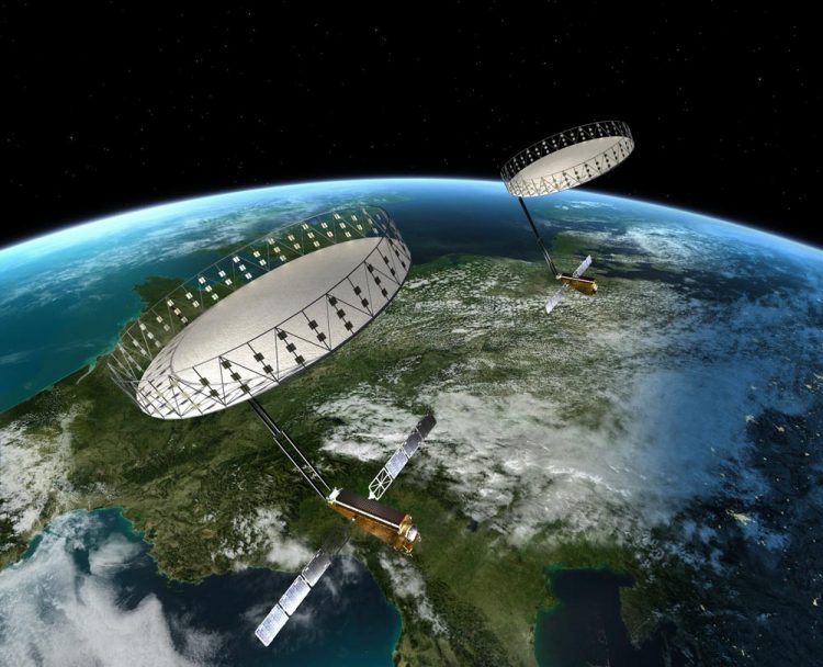
The Tandem-L satellites with large unfurlable reflector antennas in formation flight (Grafik: DLR)
Scientists from the Alfred Wegener Institute are developing with experts from the German Aerospace Centre (DLR) a new satellite measurement method for the observation from space of the large ice masses of Greenland and the Antarctic.
“Tandem-L” is the name of a new satellite radar system, which launched in the year 2022 could provide urgently needed data concerning the shrinkage of the ice sheets in both hemispheres. Concerning the construction of the radar and the launch of the satellite mission of the same name, the Science Council is to advise the Federal Ministry of Education and Research (BMBF) at the end of November as part of a review procedure.
“Extreme” is the word glaciologists now use to describe the extent of the annual summer melt on the surface of the Greenland ice sheet. This year, the scientists observed, especially in the north-east of Greenland, a widespread network of supraglacial lakes and streams on the ice sheet. Their water masses give cause for concern, above all for one reason: The melt water almost always makes its way through the ice sheet. At the ice base this water acts like a lubricant. It increases the speed at which the glaciers move. The result: Larger ice masses slip into the ocean; the sea level rises to a greater extent.
In order to be able to investigate the effects of surface melt on the glaciers and ice sheets of the world more profoundly and, above all, in large areas, scientists from the Alfred Wegener Institute have been assisting experts from the German Aerospace Centre over the past four years to create a new, satellite-based radar concept. This detects the changes in the ice sheets for the first time using a tomographic method and, for example, makes the penetration of the melt water visible.
“The new Tandem-L radar operates in the so-called L-band range. It emits radio waves with a wavelength of 24 centimetres, which in contrast to the previous satellite technology penetrate up to 100 metres deep in ice and snow. Thus, glaciologists would have the first opportunity to extensively screen the topmost ice layer of the glaciers and ice sheets from space and to map their inner structure. In addition, we can also measure the changes in the glacier surface with Tandem-L”, says Professor Angelika Humbert, Head of the Glaciology Section at the Alfred Wegener Institute, Helmholtz Centre for Polar and Marine Research (AWI).
For the Tandem-L mission, she and her team had initially analysed data from the already operating satellites TerraSAR-X and TanDEM-X. On the basis of this, they were able to develop methods of analysis and filtration that could be used to understand the origin of the structures in the Tandem-L images and to use the data for ice modelling.
To date, glaciologists have used aircraft or satellite-based altimeters to measure the topography of the ice surface in Greenland and the Antarctic and to calculate the ice losses of ice sheets by means of the differences in altitude. Altimeters scan the surface with the aid of lasers or radar. It is important that the waves emitted by the satellites do not penetrate the ice surface. The new Tandem-L system, on the other hand, will look deep into the ice and allow scientists to gain completely new insights with its high-resolution L-band data.
The satellite mission Tandem-L consists of two satellites, each of which is equipped with an L-band radar and are to orbit around the Earth in formation at an altitude of 760 kilometres. The radars scan the Earth's surface with a strip 175 to 350 kilometres wide. “Tandem-L will not only provide us with important ice information, but also receive urgently needed data on global forest biomass, soil moisture and ocean currents”, says the scientific coordinator of the satellite mission Professor Irena Hajnsek from the Microwaves and Radar Institute at DLR.
At the beginning of this year, the BMBF launched an assessment procedure for the development of a roadmap for research infrastructures in Germany. Within the scope of this, the Scientific Council meets at the end of this month and, among other things, advises on the Tandem-L mission. The results of the assessment are expected for mid-2017.
Notes for Editors:
For more information please download the flyer which you can find in the online version of this press release; please find printable images as well: http://www.awi.de/nc/en/about-us/service/press/press-release/neue-satellitentechnik-verspricht-grosse-fortschritte-fuer-die-gletscher-forschung.html
Related websites
• AWI, Glaciology Section: http://www.awi.de/en/science/geosciences/glaciology.html
• DLR, Microwaves and Radar Institute: http://www.dlr.de/hr/en/desktopdefault.aspx
• Tandem-L: http://www.tandem-l.de/
Your scientic contact persons at AWI and DLR are:
• Professor Angelika Humbert (tel: +49 471 4831-1834; e-mail: Angelika.Humbert(at)awi.de)
• Professor Alberto Moreira (tel.: +49 8153 28-2306; e-mail: Alberto.Moreira(at)dlr.de)
• Professor Irena Hajnsek (tel.: +49 8153 28-2363; e-mail: Irena.Hajnsek(at)dlr.de)
Your contact persons at the Press Offices are:
• Sina Löschke (tel: +49 471 4831-2008; e-mail: medien(at)awi.de)
• Elisabeth Schreier (tel.: +49 8153 28-1787; e-mail: Elisabeth.Schreier(at)dlr.de)
Follow the Alfred Wegener Institute on Twitter (https://twitter.com/AWI_Media) and Facebook (http://www.facebook.com/AlfredWegenerInstitute).
The Alfred Wegener Institute, Helmholtz Centre for Polar and Marine Research (AWI) conducts research in the Arctic, Antarctic and oceans of the high and mid-latitudes. It coordinates polar research in Germany and provides major infrastructure to the international scientific community, such as the research icebreaker Polarstern and stations in the Arctic and Antarctica. The Alfred Wegener Institute is one of the 18 research centres of the Helmholtz Association, the largest scientific organisation in Germany.
Media Contact
All latest news from the category: Earth Sciences
Earth Sciences (also referred to as Geosciences), which deals with basic issues surrounding our planet, plays a vital role in the area of energy and raw materials supply.
Earth Sciences comprises subjects such as geology, geography, geological informatics, paleontology, mineralogy, petrography, crystallography, geophysics, geodesy, glaciology, cartography, photogrammetry, meteorology and seismology, early-warning systems, earthquake research and polar research.


Newest articles

High-energy-density aqueous battery based on halogen multi-electron transfer
Traditional non-aqueous lithium-ion batteries have a high energy density, but their safety is compromised due to the flammable organic electrolytes they utilize. Aqueous batteries use water as the solvent for…

First-ever combined heart pump and pig kidney transplant
…gives new hope to patient with terminal illness. Surgeons at NYU Langone Health performed the first-ever combined mechanical heart pump and gene-edited pig kidney transplant surgery in a 54-year-old woman…

Biophysics: Testing how well biomarkers work
LMU researchers have developed a method to determine how reliably target proteins can be labeled using super-resolution fluorescence microscopy. Modern microscopy techniques make it possible to examine the inner workings…

