First evidence that dust and sand deposits in China are controlled by rivers
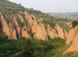
Northern China holds some of the world's most significant wind-blown dust deposits, known as loess. The origin of this loess-forming dust and its relationship to sand has previously been the subject of considerable debate.<br><br>Credit: Royal Holloway University<br>
Northern China holds some of the world's most significant wind-blown dust deposits, known as loess. The origin of this loess-forming dust and its relationship to sand has previously been the subject of considerable debate.
The team of researchers led by Royal Holloway University, analysed individual grains of fine wind-blown dust deposited in the Chinese Loess Plateau that has formed thick deposits over the past 2.5 million years. As part of this, they also analysed the Mu Us desert in Inner Mongolia and the Yellow River, one of the world's longest rivers, to identify links between the dust deposits and nearby deserts and rivers.
The results showed that the Yellow River transports large quantities of sediment from northern Tibet to the Mu Us desert and further suggests that the river contributes a significant volume of material to the Loess Plateau.
“The Yellow River drains the northeast Tibetan plateau and so the uplift of this region and the development of Yellow River drainage seems to control the large scale dust deposits and sand formation in this part of China,” said lead researcher Tom Stevens from the Department of Geography at Royal Holloway.
“Identifying how this dust is formed and controlled is important, since it drives climate change and ocean productivity and impacts human health. Its relationship to the river and Tibet implies strong links between tectonics and climate change. This suggests that global climate change caused by atmospheric dust may be influenced by the uplift of Tibet and changes in major river systems that drain this area.”
Media Contact
More Information:
http://www.rhul.ac.ukAll latest news from the category: Earth Sciences
Earth Sciences (also referred to as Geosciences), which deals with basic issues surrounding our planet, plays a vital role in the area of energy and raw materials supply.
Earth Sciences comprises subjects such as geology, geography, geological informatics, paleontology, mineralogy, petrography, crystallography, geophysics, geodesy, glaciology, cartography, photogrammetry, meteorology and seismology, early-warning systems, earthquake research and polar research.


Newest articles

Trotting robots reveal emergence of animal gait transitions
A four-legged robot trained with machine learning by EPFL researchers has learned to avoid falls by spontaneously switching between walking, trotting, and pronking – a milestone for roboticists as well…

Innovation promises to prevent power pole-top fires
Engineers in Australia have found a new way to make power-pole insulators resistant to fire and electrical sparking, promising to prevent dangerous pole-top fires and reduce blackouts. Pole-top fires pose…

Possible alternative to antibiotics produced by bacteria
Antibacterial substance from staphylococci discovered with new mechanism of action against natural competitors. Many bacteria produce substances to gain an advantage over competitors in their highly competitive natural environment. Researchers…

