NASA sees Extra-Tropical Storm Dolphin moving toward Sea of Okhotsk
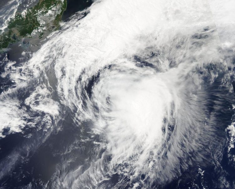
This visible light image of Extra-Tropical Storm Dolphin was captured by the MODIS instrument aboard NASA's Aqua satellite on May 20. Credits: NASA Goddard MODIS Rapid Response Team
The Moderate Resolution Imaging Spectroradiometer or MODIS instrument that flies aboard Aqua captured a visible light image of Extra-Tropical Storm Dolphin on May 20. The image showed that the bulk of clouds and showers were pushed east of the center as a result of its interaction with the westerlies (winds).
When a tropical cyclone becomes extra-tropical it has lost its “tropical” characteristics.
According to the National Oceanic and Atmospheric Administration, the term “extra-tropical” implies both poleward displacement (it moves closer to the north or south pole depending on what hemisphere it is located in) of the cyclone and the conversion of the cyclone's primary energy source from the release of latent heat of condensation to baroclinic (the temperature contrast between warm and cold air masses) processes.
It is important to note that cyclones can become extra-tropical and still retain winds of hurricane or tropical storm force.
On May 20 at 1550 UTC (11:50 a.m. EDT), Extra-tropical Storm Dolphin was located near 34.7 north latitude and 150.2 east longitude, east of Japan. Extra-tropical Storm Dolphin had maximum sustained winds near 55 knots and was weakening. It was moving to the north-northeast at 38 knots (70 kph).
Dolphin was moving to the northeast passing south of the Sea of Okhotsk and is expected to turn to the north, tracking east of Russia's Kamchatka Peninsula while continuing to weaken.
For updates on the remnants of Dolphin, visit: http://www.
Media Contact
All latest news from the category: Earth Sciences
Earth Sciences (also referred to as Geosciences), which deals with basic issues surrounding our planet, plays a vital role in the area of energy and raw materials supply.
Earth Sciences comprises subjects such as geology, geography, geological informatics, paleontology, mineralogy, petrography, crystallography, geophysics, geodesy, glaciology, cartography, photogrammetry, meteorology and seismology, early-warning systems, earthquake research and polar research.


Newest articles

A universal framework for spatial biology
SpatialData is a freely accessible tool to unify and integrate data from different omics technologies accounting for spatial information, which can provide holistic insights into health and disease. Biological processes…

How complex biological processes arise
A $20 million grant from the U.S. National Science Foundation (NSF) will support the establishment and operation of the National Synthesis Center for Emergence in the Molecular and Cellular Sciences (NCEMS) at…

Airborne single-photon lidar system achieves high-resolution 3D imaging
Compact, low-power system opens doors for photon-efficient drone and satellite-based environmental monitoring and mapping. Researchers have developed a compact and lightweight single-photon airborne lidar system that can acquire high-resolution 3D…

