NASA's Aqua Satellite Sees Extra-Tropical Storm Vongfong Pulling Away from Hokkaido, Japan
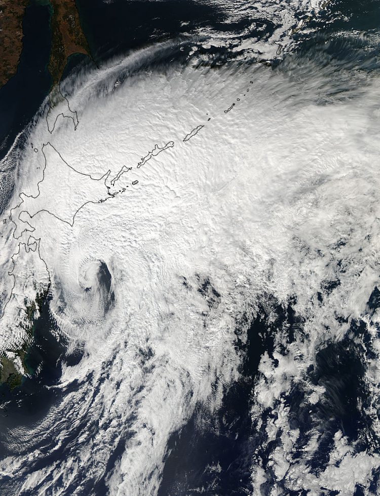
The MODIS instrument aboard NASA's Aqua satellite captured this image of Tropical Storm Vongfong over Japan on Oct. 14 at 03:15 UTC as it was southeast of the island of Hokkaido, Japan. Image Credit: NASA Goddard MODIS Rapid Response Team
Vongfong transitioned into an extra-tropical storm early on Oct. 4 as its core changed from warm to cold.
The MODIS or Moderate Resolution Imaging Spectroradiometer instrument aboard NASA's Aqua satellite captured a visible image of Tropical Storm Vongfong over Japan on Oct. 14 at 03:15 UTC as it was southeast of the island of Hokkaido, Japan.
The image showed that south of the center of circulation was almost devoid of clouds and showers, which were all pushed to the north and east of the center as a result of southwesterly wind shear.
At 0300 UTC on Oct. 14, the Joint Typhoon Warning Center issued its final advisory on Tropical storm Vongfong.
At that time Vongfong's center was located near 29.1 north latitude and 142.9 east longitude, about 111 nautical miles (127.7 miles/205.6 km) southeast of Misawa, Japan.
Vongfong was moving to the northeast at a speedy 36 knots (41.4 mph/66.67 kph). Vongfong's maximum sustained winds were near 35 knots (40.2 mph/64.8 kph).
Vongfong had transitioned into an extra-tropical system and will continue to move away from northern Japan and over the northwestern Pacific Ocean.
Rob Gutro
NASA's Goddard Space Flight Center
Media Contact
All latest news from the category: Earth Sciences
Earth Sciences (also referred to as Geosciences), which deals with basic issues surrounding our planet, plays a vital role in the area of energy and raw materials supply.
Earth Sciences comprises subjects such as geology, geography, geological informatics, paleontology, mineralogy, petrography, crystallography, geophysics, geodesy, glaciology, cartography, photogrammetry, meteorology and seismology, early-warning systems, earthquake research and polar research.


Newest articles

A universal framework for spatial biology
SpatialData is a freely accessible tool to unify and integrate data from different omics technologies accounting for spatial information, which can provide holistic insights into health and disease. Biological processes…

How complex biological processes arise
A $20 million grant from the U.S. National Science Foundation (NSF) will support the establishment and operation of the National Synthesis Center for Emergence in the Molecular and Cellular Sciences (NCEMS) at…

Airborne single-photon lidar system achieves high-resolution 3D imaging
Compact, low-power system opens doors for photon-efficient drone and satellite-based environmental monitoring and mapping. Researchers have developed a compact and lightweight single-photon airborne lidar system that can acquire high-resolution 3D…

