A new parameterization of canopy radiative transfer for land surface radiation models
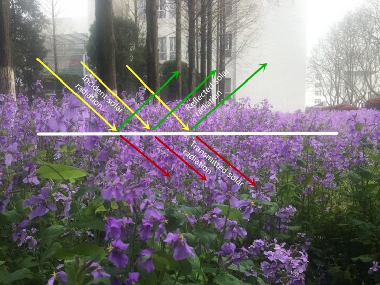
This is an illustration of canopy radiative transfer. Credit: Feng Zhang
However, the canopy varies geographically from that of dense tropical forests to the shrublands of arid desert lands, and temporally from the vibrancy of spring to the gloominess of winter. Uncertainties are abound in the processes of radiative transfer parameterization.
Dr Feng Zhang and his collaborators propose a new parameterization for the canopy phase function, which is based on the leaf normal distribution and leaf reflection/transmission, and examine the accuracy in reflection and transmission of the canopy through comparison with the benchmark result of SOSA. The findings are published in Advances in Atmospheric Sciences (Zhang et al., 2017).
“The new method,” says Dr. Zhang, “when based on Eddington approximation, can substantially improve the accuracy compared to the previously preferred hemispheric constant method, under both isotropic and anisotropic conditions. Therefore, the canopy albedo can be evaluated more accurately by the analytical solution of non-zero soil background reflection.”
Moreover, their investigation also reveals that there is a relationship between the direct radiation and the diffuse radiation of the canopy, which have been treated separately in previous studies. It is concluded that the new parameterization is well suited for applications of land surface radiation modeling.
Media Contact
All latest news from the category: Earth Sciences
Earth Sciences (also referred to as Geosciences), which deals with basic issues surrounding our planet, plays a vital role in the area of energy and raw materials supply.
Earth Sciences comprises subjects such as geology, geography, geological informatics, paleontology, mineralogy, petrography, crystallography, geophysics, geodesy, glaciology, cartography, photogrammetry, meteorology and seismology, early-warning systems, earthquake research and polar research.


Newest articles

A universal framework for spatial biology
SpatialData is a freely accessible tool to unify and integrate data from different omics technologies accounting for spatial information, which can provide holistic insights into health and disease. Biological processes…

How complex biological processes arise
A $20 million grant from the U.S. National Science Foundation (NSF) will support the establishment and operation of the National Synthesis Center for Emergence in the Molecular and Cellular Sciences (NCEMS) at…

Airborne single-photon lidar system achieves high-resolution 3D imaging
Compact, low-power system opens doors for photon-efficient drone and satellite-based environmental monitoring and mapping. Researchers have developed a compact and lightweight single-photon airborne lidar system that can acquire high-resolution 3D…

