NASA's ICESat-2 equipped with unique 3-D manufactured part
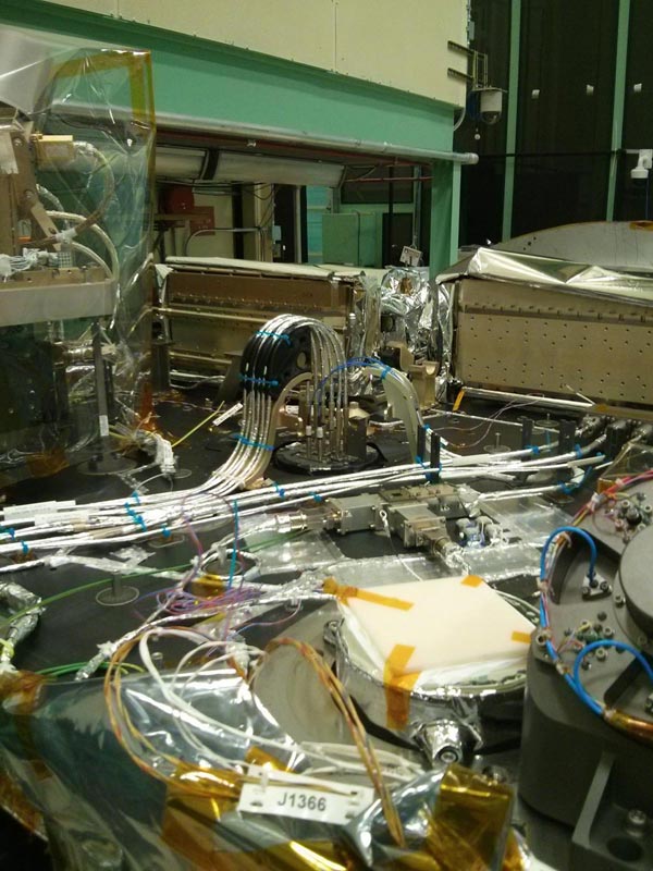
The 3-D manufactured part -- a black bracket holding the instrument's fiber-optic cables -- is visible in the back of the ATLAS instrument. Credit: NASA
Slated for launch in 2018, NASA's Ice, Cloud and land Elevation Satellite-2 (ICESat-2) also will carry a 3-D printed part made of polyetherketoneketone (PEKK), a material that has never been used in 3-D manufacturing, let alone flown in space.
“This is a first for this material,” said Craig Auletti, lead production engineer on ICESat-2's only instrument, the Advanced Topographic Laser Altimeter System (ATLAS) now being built at NASA's Goddard Space Flight Center in Greenbelt, Maryland. The part is a bracket that supports the instrument's fiber-optic cables.
PEKK Offers Advantages
Instrument developers chose PEKK because it's strong, but perhaps more important, it's electrostatically dissipative — that is, it reduces the build up of static electricity to protect electrostatically sensitive devices.
It also produces very little outgassing, a chemical process similar to what happens when plastics and other materials release gas, producing, for example, the “new car smell” in vehicles. In a vacuum or under heated conditions, these outgassed contaminants can condense on and harm optical devices and thermal radiators, significantly degrading instrument performance.
Although 3-D or additive manufacturing is used to create a variety of products, so far, it remains a rare occurrence in spaceflight applications. In fact, the PEKK bracket is believed to be only the second 3-D manufactured part to be flown in a spaceflight instrument, said Oren Sheinman, the ATLAS mechanical systems engineer NASA Goddard.
Three-dimensional parts printed of Ultem 9085 were produced and flown on the International Space Station by the NASA Ames Research Center's Synchronized Position Hold, Engage, Reorient, Experimental Satellites (SPHERES) program.
Additive or 3-D manufacturing is attractive because it offers a fast, low-cost alternative to traditional manufacturing. With additive manufacturing, a computer-operated device literally prints a solid object, layer by layer, using a high-power optic laser that melts and fuses powdered materials in precise locations using a 3-D CAD model. “Had we manufactured this part classically, it would have taken six to eight weeks. We got it in two days,” Sheinman said, adding that costs to the project were up to four times less than with a traditionally machined part.
ATLAS: A Technical Marvel
The bracket, however is just one of the mission's firsts. ATLAS, itself, is a technical marvel, said ATLAS Instrument Scientist Tony Martino. It will be NASA's first space-borne, photon-counting laser altimeter and is expected to usher in a new, more precise method for measuring surface elevations.
As with its predecessor, ICESat-2 is designed to measure changes in ice-sheet elevations in Greenland and the Antarctic, sea-ice thicknesses, and global vegetation. However, it will execute its mission using a never-before-flown technique.
ICESat, which ended operations in 2009, employed a single laser, which made it more difficult to measure changes in the elevation of an ice sheet. With a single beam, researchers couldn't tell if the snowpack had melted or if the laser was slightly off and pointed down a hill. ICESat-2 overcomes those challenges by splitting the green-light laser into six beams, arranged in three pairs, firing continuously at a rapid 10,000 pulses per second toward Earth.
Unlike analog-laser altimetry, which uses analog detectors and digitizes the return signal, ICESat-2 will employ a technique called photon counting. Used in aircraft instruments, photon counting has not yet been used for altimetry in a spaceflight instrument. It more precisely records the time-of-flight of individual photons as they travel from the instrument, reflect off Earth's surface, and then are detected as they return to the instrument's detectors — measurements that scientists use to calculate Earth's surface elevation.
Perhaps more important to scientists who want to know how the ice sheets change over time, the multiple beams will give scientists dense cross-track samples that will help them determine a surface's slope, while the high-pulse rate will allow ATLAS to take measurements every 2.3 feet along the satellite's ground path — all at a higher resolution due to the photon counting.
“This is one of the new capabilities,” Martino said. “We're getting cross track slope every time the satellite passes over.” Furthermore, the satellite will pass over the same area every 90 days during ICESat-2's three-year mission, giving scientists a very detailed multi-year snapshot of how the ice is changing.
“It's almost completely built,” Martino said, adding that the spacecraft will fly on the last Delta II launch vehicle. “All functional parts are there and our first comprehensive testing starts in February. We're on track.”
###
For more Goddard technology news, go to https:/
Media Contact
All latest news from the category: Information Technology
Here you can find a summary of innovations in the fields of information and data processing and up-to-date developments on IT equipment and hardware.
This area covers topics such as IT services, IT architectures, IT management and telecommunications.


Newest articles

A universal framework for spatial biology
SpatialData is a freely accessible tool to unify and integrate data from different omics technologies accounting for spatial information, which can provide holistic insights into health and disease. Biological processes…

How complex biological processes arise
A $20 million grant from the U.S. National Science Foundation (NSF) will support the establishment and operation of the National Synthesis Center for Emergence in the Molecular and Cellular Sciences (NCEMS) at…

Airborne single-photon lidar system achieves high-resolution 3D imaging
Compact, low-power system opens doors for photon-efficient drone and satellite-based environmental monitoring and mapping. Researchers have developed a compact and lightweight single-photon airborne lidar system that can acquire high-resolution 3D…

