Tropical Cyclone Bavi moving through Philippine Sea
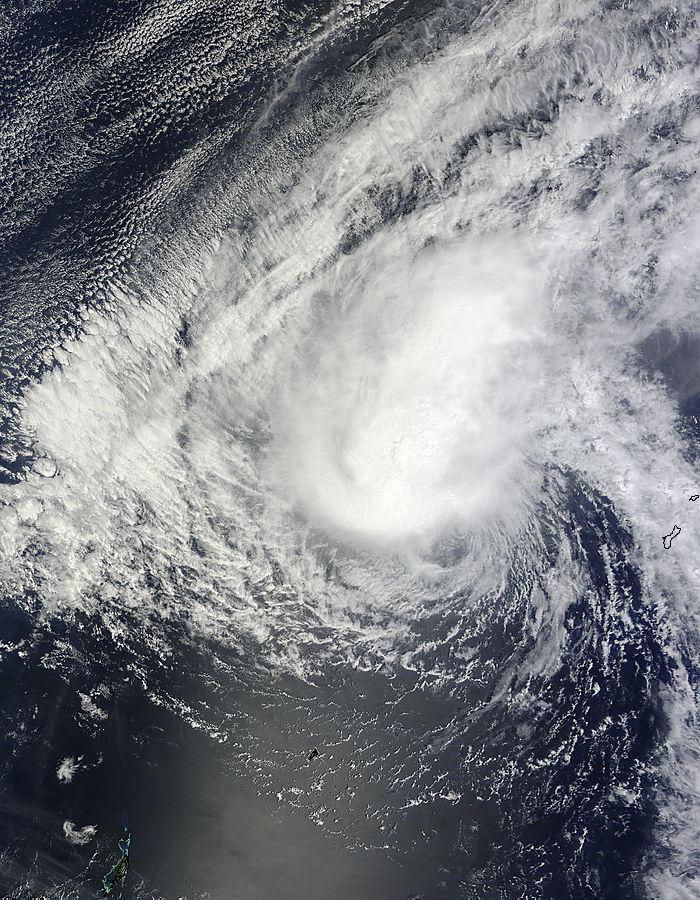
On March 16 at 01:35 UTC, the MODIS instrument aboard Aqua provided a visible image of the Tropical Cyclone avi moving through the Philippine Sea. Credit: NASA Goddard MODIS Rapid Response Team
On March 16 at 01:35 UTC, the Moderate Resolution Imaging Spectroradiometer (MODIS) instrument aboard Aqua provided a visible image of the storm. The storm appeared somewhat elongated with strong thunderstorms stretching from the center, northwest of the center as a result of moderate southeasterly vertical wind shear.
An infrared image from the Atmospheric Infrared Sounder or AIRS instrument that also flies aboard Aqua revealed the coldest cloud top temperatures of powerful thunderstorms were as cold as -63F/-52C, indicating they have the potential for dropping heavy rainfall. Those thunderstorms circled the center and northwestern quadrant of the storm.
At 1500 UTC (11 a.m. EDT), Bavi's maximum sustained winds were near 40 knots (46 mph/74 kph). It was centered near 14.2 north latitude and 138.4 east longitude, about 254 nautical miles north of Ulithi. Ulithi is an atoll located in the Caroline Islands.
Bavi was moving to the west-northwestward at 8 knots (9.2 mph/14.8 kph).
Bavi is forecast to continue on a westerly trek through the Philippine Sea, but is expected to weaken to a depression as it nears the northern Philippines. The Joint Typhoon Warning Center current forecast track takes the storm near eastern Luzon sometime on March 20.
Media Contact
All latest news from the category: Earth Sciences
Earth Sciences (also referred to as Geosciences), which deals with basic issues surrounding our planet, plays a vital role in the area of energy and raw materials supply.
Earth Sciences comprises subjects such as geology, geography, geological informatics, paleontology, mineralogy, petrography, crystallography, geophysics, geodesy, glaciology, cartography, photogrammetry, meteorology and seismology, early-warning systems, earthquake research and polar research.


Newest articles

A universal framework for spatial biology
SpatialData is a freely accessible tool to unify and integrate data from different omics technologies accounting for spatial information, which can provide holistic insights into health and disease. Biological processes…

How complex biological processes arise
A $20 million grant from the U.S. National Science Foundation (NSF) will support the establishment and operation of the National Synthesis Center for Emergence in the Molecular and Cellular Sciences (NCEMS) at…

Airborne single-photon lidar system achieves high-resolution 3D imaging
Compact, low-power system opens doors for photon-efficient drone and satellite-based environmental monitoring and mapping. Researchers have developed a compact and lightweight single-photon airborne lidar system that can acquire high-resolution 3D…

