Newborn Tropical Storm Phanfone triggers warnings in Northwestern Pacific
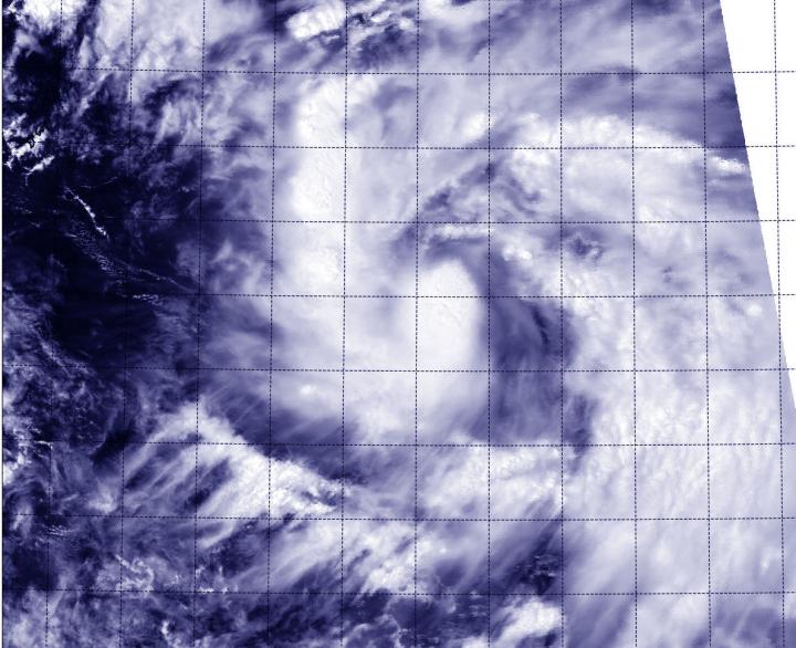
The MODIS instrument aboard NASA's Aqua satellite took this visible image of Tropical Storm Phanfone in the Northwestern Pacific, on track for the Northern Marianas Islands. Credit: NASA Goddard MODIS Rapid Response Team
A tropical storm Warning is in effect for Saipan, Tinian, Pagan and Alamagan. In addition, a typhoon watch is in effect for the northern Marianas Islands, including Pagan and Alamagan.
The Moderate Resolution Imaging Spectroradiometer (MODIS) aboard Aqua provides visible and infrared images of storms, oceans and land features.
On Sept. 29 at 11 a.m. EDT (1500 UTC) Phanfone had maximum sustained winds near 40 knots (46 mph/74 kph). It was centered near 13.8 north latitude and 149.6 east longitude, about 270 nautical miles east-southeast of Saipan. Phanfone is moving to the west-northwest at 11 knots (12.6 mph/20.3 kph).
The U.S. National Weather Service in Guam issued a statement on Sept. 29 about Phanfone's approach: “Tropical Storm Phanfone will be strengthening into a typhoon as it crosses the Northern Mariana Islands with the center passing near…most likely north of Saipan on Sept. 30, Tuesday night or early Wednesday, Oct. 1.
It is important to note that only small changes in the forecast track and intensity will lead to significantly varying Impacts. Expect heavy rain…thunderstorms…dangerous surf…and damaging winds.” For forecast updates, visit: http://forecast.weather.gov/MapClick.php?map.x=249&map.y=58&site=gum
Forecasters at the Joint Typhoon Warning Center expect Phanfone to intensify as it moves to the west-northwest toward the Marianas Islands. After passing through the islands, Phanfone is expected to reach typhoon strength and move west of the island of Iwo To by Oct. 2 or 3.
Media Contact
All latest news from the category: Earth Sciences
Earth Sciences (also referred to as Geosciences), which deals with basic issues surrounding our planet, plays a vital role in the area of energy and raw materials supply.
Earth Sciences comprises subjects such as geology, geography, geological informatics, paleontology, mineralogy, petrography, crystallography, geophysics, geodesy, glaciology, cartography, photogrammetry, meteorology and seismology, early-warning systems, earthquake research and polar research.


Newest articles

A universal framework for spatial biology
SpatialData is a freely accessible tool to unify and integrate data from different omics technologies accounting for spatial information, which can provide holistic insights into health and disease. Biological processes…

How complex biological processes arise
A $20 million grant from the U.S. National Science Foundation (NSF) will support the establishment and operation of the National Synthesis Center for Emergence in the Molecular and Cellular Sciences (NCEMS) at…

Airborne single-photon lidar system achieves high-resolution 3D imaging
Compact, low-power system opens doors for photon-efficient drone and satellite-based environmental monitoring and mapping. Researchers have developed a compact and lightweight single-photon airborne lidar system that can acquire high-resolution 3D…

