Geoinformatics specialists receive almost one million euros for “SenseBox“ citizen science project
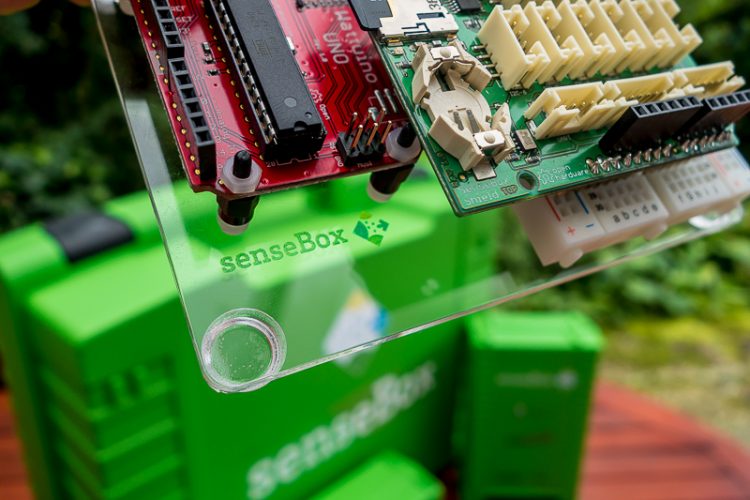
The green SenseBox contains components with which anyone can construct a measuring station. Photo: WWU/ifgi
More than 100 of the small green boxes are already in use: whether in Hamburg, or Zwolle in the Netherlands, or even on the Zugspitze in northern Tyrol – the “SenseBox” has long since left its hometown of Münster behind it.
The toolkit for stationary and mobile sensors, developed by Geoinformatics specialists at Münster, is being used by non-specialists in a lot of places to measure environmental data,– and the number of measuring stations is set to rise substantially. The German Ministry of Education and Science (BMBF) is now providing 960,000 euros of funding for the project for three years. The project coordinator is Prof. Angela Schwering from the Institute for Geoinformatics at the University of Münster.
It’s not only private households that are using the boxes, but also – and in particular – school laboratories and museums. “What’s really important to us,” says Thomas Bartoschek, who is heading the project jointly with Angela Schwering, “is that people should become involved in science through so-called citizen science projects – in other words, do measuring themselves and ask questions of their own. And the 'SenseBox' – which is also available in a version for school classes – is just the thing for that.”
With minimal effort, anyone can construct their own measuring station from the assembly kit. Anyone who likes tinkering around with such things can add on their own sensors and develop new data processing software. Data from all measuring stations is available to the general public on the internet, where the locations are also shown on a map.
What the “SenseBoxes” measure is, among other things, environmental data on light, climate, traffic density and noise pollution. In the BMBF-funded project the researchers now want to develop further sensors – to measure the degree of cloud cover and to check water and air quality.
“The 'SenseBox' has the potential to gather climate data comprehensively over an entire area. This is something that professional weather stations cannot do as there are not enough of them. But something that would be very interesting, especially as far as measuring air quality is concerned, is to get data from as many different places as possible,” says Angela Schwering. One feature is common to all the new sensors being planned: they will all measure using a technology based on light – photonics.
The researchers see room for improvement in the “SenseBox”. Some of the boxes, for example, provide unusable data because they were set up in places unsuitable for measuring activities.
“We’ll have to take this into account and properly assess the quality of the data so that we can use them scientifically,” says Thomas Bartoschek. For this reason, the Geoinformatics specialists compare the data measured in long-term tests with the data provided by professional weather stations. In the next three years they also want to develop statistical methods to optimize data evaluation.
Although receiving BMBF funding for the project – “SenseBox – Photonics and OpenSenseMap: Citizen Science for Photonic Sensor Data”, to give it its full name – is the biggest success Münster’s Geoinformatics researchers have had so far, it is not their only one. One of the other successes they have had was in December 2015, when the “SenseBox” was voted the winning project in the “Citizens create the City of the Future” competition. Just a few days ago it was also announced that the project is one of the winners of the “CodeWeekAward” 2016.
http://www.sensebox.de/en/ SenseBox
http://www.uni-muenster.de/Geoinformatics/sil/index.html Spatial Intelligence Lab – Institute for Geoinformatics
Media Contact
All latest news from the category: Awards Funding


Newest articles

A universal framework for spatial biology
SpatialData is a freely accessible tool to unify and integrate data from different omics technologies accounting for spatial information, which can provide holistic insights into health and disease. Biological processes…

How complex biological processes arise
A $20 million grant from the U.S. National Science Foundation (NSF) will support the establishment and operation of the National Synthesis Center for Emergence in the Molecular and Cellular Sciences (NCEMS) at…

Airborne single-photon lidar system achieves high-resolution 3D imaging
Compact, low-power system opens doors for photon-efficient drone and satellite-based environmental monitoring and mapping. Researchers have developed a compact and lightweight single-photon airborne lidar system that can acquire high-resolution 3D…

