NASA saw strong T-storms in quick-forming Hermine's center, warm water to power it

At 11 p.m. EDT on September 6, Hermine made landfall as a strong tropical storm producing heavy rains over northeastern Mexico and South Texas.
This morning there's a tropical storm warning in effect from Bahia Algodones, Mexico Northward to Port O'Connor, Texas as Hermine is continuing to move inland in a north-northwest direction at 17 mph. At 8 a.m. EDT, Hermine's maximum sustained winds had decreased from their peak of 60 mph to 45 mph now that she's over land in south Texas. She's centered near 27.7 North and 98.2 West, which is about 35 miles southwest of Mathis, Texas. Mathis is about 171 miles north of Brownsville, Texas, the southernmost city in the state. Minimum central pressure is 991 millibars.
Tropical Storm Hermine formed quickly in the extreme western Gulf of Mexico on Labor Day in the U.S., Monday, September 6. On Friday, Sept. 4, forecasters were watching a low pressure area, and two days later, even close to the coast tropical depression 11 formed and quickly strengthened into a tropical storm.
Infrared imagery from NASA's Aqua satellite instrument the Atmospheric Infrared Sounder (AIRS) captured Tropical Storm Hermine right after she formed on Sept. 6 at 19:53 UTC (3:53 p.m. EDT), showed strong convection and strong, high thunderstorms around the center of circulation indicating an organized tropical storm. AIRS data also showed that that sea surface temperatures where Hermine formed yesterday were about 86 degrees Fahrenheit (30 Celsius), way above the 80F threshold needed to power a tropical cyclone.
A large threat from Hermine is extreme rainfall. She's expected to produce between 4 and 8 inches of rain with isolated totals up to 12 inches from southern Texas northward through northern Texas and into central and eastern Oklahoma. The National Hurricane Center noted that the rains are expected to continue spreading northeastward into Kansas, northwestern Arkansas and Missouri over the next few days and could caused life-threatening flash floods.
The visible satellite image from the GOES-13 satellite at 11:31 UTC (7:31 a.m. EDT) on Sept. 7, 2010, showed the large extent of Tropical Storm Hermine's clouds stretching north into Oklahoma, Missouri and Arkansas, and south into northern Mexico. GOES-13 is one of the Geostationary Operational Environmental Satellites operated by NOAA. NASA's GOES Project at NASA's Goddard Space Flight Center, in Greenbelt, Md. creates images and animations from GOES satellite data.
Meanwhile, tropical-storm force winds are expected in the warning area, and isolated tornadoes are possible across portions of southeast Texas through today.
Media Contact
More Information:
http://www.nasa.govAll latest news from the category: Earth Sciences
Earth Sciences (also referred to as Geosciences), which deals with basic issues surrounding our planet, plays a vital role in the area of energy and raw materials supply.
Earth Sciences comprises subjects such as geology, geography, geological informatics, paleontology, mineralogy, petrography, crystallography, geophysics, geodesy, glaciology, cartography, photogrammetry, meteorology and seismology, early-warning systems, earthquake research and polar research.
Newest articles

A universal framework for spatial biology
SpatialData is a freely accessible tool to unify and integrate data from different omics technologies accounting for spatial information, which can provide holistic insights into health and disease. Biological processes…

How complex biological processes arise
A $20 million grant from the U.S. National Science Foundation (NSF) will support the establishment and operation of the National Synthesis Center for Emergence in the Molecular and Cellular Sciences (NCEMS) at…

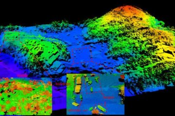
Airborne single-photon lidar system achieves high-resolution 3D imaging
Compact, low-power system opens doors for photon-efficient drone and satellite-based environmental monitoring and mapping. Researchers have developed a compact and lightweight single-photon airborne lidar system that can acquire high-resolution 3D…


