Spotlight on Sentinel-2
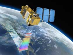
Sentinel-2 will provide systematic global acquisitions of high-resolution multispectral imagery for Europe's Global Monitoring for Environment and Security (GMES) programme. <br>Credits: Astrium GmbH<br>
The humid and moist tropical climate of Gabon yields immense forests that cover over 85% of the land, making them the number-two driver of the national economy – and deforestation a subject of concern.
The GMES project on Forest Monitoring Reducing Emissions from Deforestation and Degradation mapped deforestation in Gabon from 1990 to 2010 using NASA’s Landsat satellite.
But the Equatorial African country’s heavy cloud cover means that imagery is often difficult to acquire over some areas.
While it takes Landsat 1.5–3.5 years to obtain imagery of the entire country, the future Sentinel-2 mission would require less than a year because of its more frequent coverage.
The future monitoring of land cover by Sentinel-2 was just one of the many topics covered at the Sentinel-2 Preparatory Symposium, hosted this week at ESA’s ESRIN centre for Earth observation in Frascati, Italy.
Other applications discussed include forestry, agriculture, cartography and the mapping of glaciers and wetlands.
“Sentinel-2 will fill the gap from both a research and operations perspective,” said Chris Steenmans, Head of Programme at the European Environment Agency’s Shared Environmental Information System.
“We are currently struggling with fragmented satellite data, so the timely information that Sentinel-2 will provide is important. The mission will also complement other Earth observation investments on a global level.”
Sentinel-2, planned for launch next year, is one of five Sentinel missions that ESA is developing for Europe’s Global Monitoring for Environment and Security (GMES) programme.
Through GMES, decision-makers will have access to reliable, timely and accurate information services to manage the environment, understand and mitigate the effects of climate change and ensure civil security.
At the recent symposium, Medhavy Thankappan, Director of Science and Strategy at Geoscience Australia’s National Earth Observation Group, presented a national land cover dataset based on analysis of satellite data acquired over an eight-year period.
The dataset will provide the basis for monitoring Australia’s water resources, agricultural practices, soil erosion and forests.
“The next step is to update the land cover information with new data from a consistent source – to move from mapping to monitoring,” said Mr Thankappan.
“We would also like to move to a higher spatial resolution – that’s where Sentinel-2 comes in.”
Owing to its high resolution of 10 m per pixel, and wide swath of 290 km, global products from Sentinel-2 will be able to be applied locally.
The mission will adhere to the Sentinel Data Policy, which establishes full and open access to data acquired by all five of the upcoming Sentinels.
Participants at the symposium, however, expressed concern over the data delivery arrangement.
“Sentinel-2 is like a dream come true for the forest remote sensing community,” said Tuomas Häme, Research Professor at the VTT Technical Research Centre of Finland.
“It is of utmost importance that the mission can be fully utilised by organising data delivery to the users as smoothly as it is organised for the similar missions with a free and open data policy.”
Media Contact
More Information:
http://www.esa.intAll latest news from the category: Information Technology
Here you can find a summary of innovations in the fields of information and data processing and up-to-date developments on IT equipment and hardware.
This area covers topics such as IT services, IT architectures, IT management and telecommunications.


Newest articles

A universal framework for spatial biology
SpatialData is a freely accessible tool to unify and integrate data from different omics technologies accounting for spatial information, which can provide holistic insights into health and disease. Biological processes…

How complex biological processes arise
A $20 million grant from the U.S. National Science Foundation (NSF) will support the establishment and operation of the National Synthesis Center for Emergence in the Molecular and Cellular Sciences (NCEMS) at…

Airborne single-photon lidar system achieves high-resolution 3D imaging
Compact, low-power system opens doors for photon-efficient drone and satellite-based environmental monitoring and mapping. Researchers have developed a compact and lightweight single-photon airborne lidar system that can acquire high-resolution 3D…

