Typhoon Kilo moving through northwestern Pacific Ocean
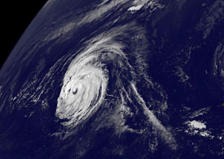
At 11 a.m. EDT on Sept. 2, Typhoon Kilo's eye was visible in a GOES-West satellite image. Credits: NASA/NOAA GOES Project
At 11 a.m. EDT on September 2, Typhoon Kilo's maximum sustained winds were near 90 knots (103.6 mph/166.7 kph).
It was centered near 24.3 North and 179.1 East, about 762 nautical miles east-northeast of Wake Island. Kilo was moving very slowly at 3 knots (3.4 mph/5.5 kph).
At that time, Typhoon Kilo's eye was visible in a satellite image from NOAA's GOES-West satellite. The image also showed powerful bands of thunderstorms wrapping into the low level center of circulation.
GOES-West is managed by NOAA. The image was created by NASA/NOAA's GOES Project at NASA's Goddard Space Flight Center in Greenbelt, Maryland.
Fortunately, Kilo is in open waters and is currently no threat to land areas.
The Joint Typhoon Warning Center expects Kilo to re-strengthen and continue tracking west. It is expected to peak in intensity on September 6.
Media Contact
All latest news from the category: Earth Sciences
Earth Sciences (also referred to as Geosciences), which deals with basic issues surrounding our planet, plays a vital role in the area of energy and raw materials supply.
Earth Sciences comprises subjects such as geology, geography, geological informatics, paleontology, mineralogy, petrography, crystallography, geophysics, geodesy, glaciology, cartography, photogrammetry, meteorology and seismology, early-warning systems, earthquake research and polar research.


Newest articles

A universal framework for spatial biology
SpatialData is a freely accessible tool to unify and integrate data from different omics technologies accounting for spatial information, which can provide holistic insights into health and disease. Biological processes…

How complex biological processes arise
A $20 million grant from the U.S. National Science Foundation (NSF) will support the establishment and operation of the National Synthesis Center for Emergence in the Molecular and Cellular Sciences (NCEMS) at…

Airborne single-photon lidar system achieves high-resolution 3D imaging
Compact, low-power system opens doors for photon-efficient drone and satellite-based environmental monitoring and mapping. Researchers have developed a compact and lightweight single-photon airborne lidar system that can acquire high-resolution 3D…

