Satellite images of Asian disaster
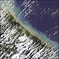
Envisat MERIS image dated 28 December 2004 showing northeast coast of Sri Lanka
A week after the tsunami that hit Asia on 26 December the death toll is still rising. Nearly 140 000 people are confirmed dead, more than 1.8 million people need food aid and an estimated five million are homeless.
The tsunami formed when an earthquake of 9.0 magnitude vertically jolted the seabed by several metres, displacing hundreds of cubic kilometres of water. The epicentre was 320 km west of Medan, just off the west coast of the Indonesia island of Sumatra. The people of Indonesia, Sri Lanka, India and Thailand are hardest hit but people in countries as far away as Kenya and Tanzania have also suffered damage and loss of life.
Since the disaster struck, three authorised users of the International Charter on Space and Major Disasters have requested its support from the on-duty operator at ESA/ESRIN. Satellite images of the disaster areas taken before and after the tsunami have been supplied to the UN Office of Outer Space Affairs, the French Civil Protection and the Indian Space Research Organisation.
Current members of the International Charter on Space and Major Disasters include ESA Member States, Argentina, Canada, India, Japan and the USA. Civil protection authorities from other countries can also submit requests by contacting their partner organisations through existing cooperation mechanisms to help them in the major relief efforts that are now underway.
Media Contact
All latest news from the category: Earth Sciences
Earth Sciences (also referred to as Geosciences), which deals with basic issues surrounding our planet, plays a vital role in the area of energy and raw materials supply.
Earth Sciences comprises subjects such as geology, geography, geological informatics, paleontology, mineralogy, petrography, crystallography, geophysics, geodesy, glaciology, cartography, photogrammetry, meteorology and seismology, early-warning systems, earthquake research and polar research.


Newest articles

A universal framework for spatial biology
SpatialData is a freely accessible tool to unify and integrate data from different omics technologies accounting for spatial information, which can provide holistic insights into health and disease. Biological processes…

How complex biological processes arise
A $20 million grant from the U.S. National Science Foundation (NSF) will support the establishment and operation of the National Synthesis Center for Emergence in the Molecular and Cellular Sciences (NCEMS) at…

Airborne single-photon lidar system achieves high-resolution 3D imaging
Compact, low-power system opens doors for photon-efficient drone and satellite-based environmental monitoring and mapping. Researchers have developed a compact and lightweight single-photon airborne lidar system that can acquire high-resolution 3D…

