NASA sees Tropical Cyclone Nathan moving south and strengthening
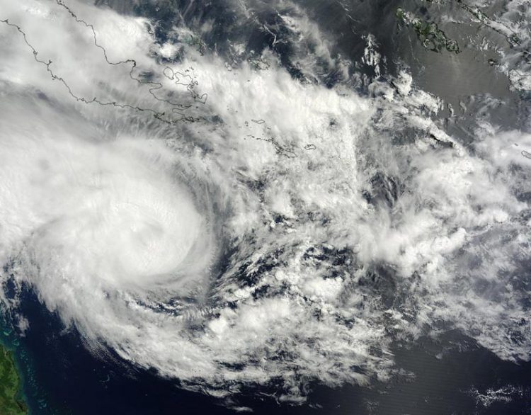
NASA's Terra satellite captured this visible image of Tropical Cyclone Nathan east of the Queensland coast on March 16 at 0:00 UTC. Credit: NASA Goddard MODIS Rapid Response
At 0900 UTC (5 a.m. EDT), Tropical cyclone Nathan's maximum sustained winds were near 55 knots (63.2 mph/102 kph) and the storm was consolidating and organizing.
The Joint Typhoon Warning Center (JTWC) forecasters expect Nathan to strengthen to 70 knots in two days.
Nathan was centered near 14.3 south latitude and 150.2 east longitude, about 298 nautical miles east-northeast of Cairns, Australia. It was moving to the southeast at 5 knots (5.7 mph/9.2 kph).
JTWC noted satellite imagery revealed “a slowly-consolidating low-level circulation center slightly to the east of the deepening convection.”
Nathan is moving southeast. The Joint Typhoon Warning center expects Nathan to strengthen to about 70 knots (80.5 mph/120.6 kph) in a couple of days before weakening again and turning back to the west toward Queensland.
Media Contact
All latest news from the category: Earth Sciences
Earth Sciences (also referred to as Geosciences), which deals with basic issues surrounding our planet, plays a vital role in the area of energy and raw materials supply.
Earth Sciences comprises subjects such as geology, geography, geological informatics, paleontology, mineralogy, petrography, crystallography, geophysics, geodesy, glaciology, cartography, photogrammetry, meteorology and seismology, early-warning systems, earthquake research and polar research.


Newest articles

A universal framework for spatial biology
SpatialData is a freely accessible tool to unify and integrate data from different omics technologies accounting for spatial information, which can provide holistic insights into health and disease. Biological processes…

How complex biological processes arise
A $20 million grant from the U.S. National Science Foundation (NSF) will support the establishment and operation of the National Synthesis Center for Emergence in the Molecular and Cellular Sciences (NCEMS) at…

Airborne single-photon lidar system achieves high-resolution 3D imaging
Compact, low-power system opens doors for photon-efficient drone and satellite-based environmental monitoring and mapping. Researchers have developed a compact and lightweight single-photon airborne lidar system that can acquire high-resolution 3D…

