Tropical Storm Vance's Center Looks Like a Pumpkin to NASA's Terra Satellite
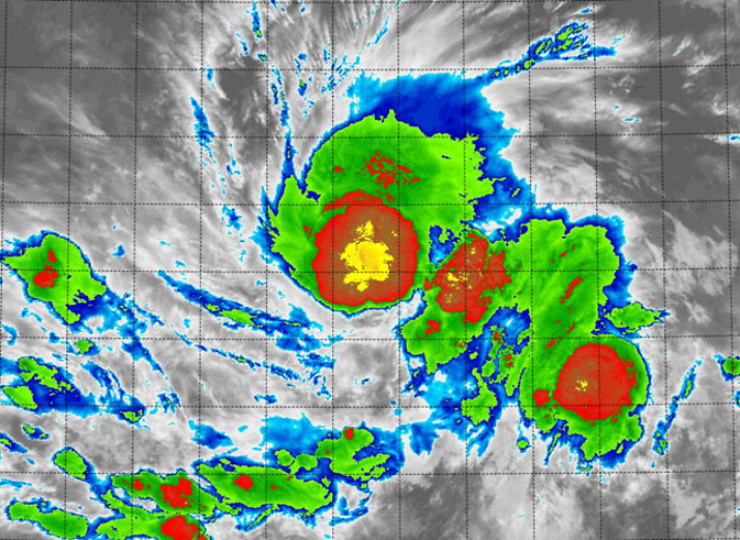
NASA's Terra satellite passed over Vance on October 31 at 12:55 a.m. EDT and saw thunderstorms around the center resembling a pumpkin with a stem in false-colored infrared imagery. Image Credit: NASA/NRL
Tropical Depression 21E formed on Oct. 30 after struggling for days as a low pressure area. Just a day later it strengthened into a tropical storm and was renamed Vance.
NASA's Terra satellite passed over Vance on October 31 at 4:55 UTC (12:55 a.m. EDT) – the witching hour – and the Moderate Resolution Imaging Spectroradiometer or MODIS instrument aboard Terra captured infrared data.
That infrared data was false-colored when the image was created. High, strong thunderstorms with cold cloud top temperatures that circled the center were false-colored in an orange-red color, and resembled the shape of a pumpkin with a stem!
At 5 a.m. EDT, Tropical Storm Vance's maximum sustained winds were near 45 mph (75 kph) and is expected to strengthen gradually. Vance was centered near latitude 10.5 north and longitude 101.0 west.
That's about 450 miles (720 km) south of Acapulco, Mexico. Vance is moving toward the west-southwest near 3 mph (6 kph) and is forecast to turn to the west and west-northwest on Nov. 1.
National Hurricane Center Forecaster Dan Brown noted that Vance's center was near the southern edge of the large mass of deep convection due to moderate south-southwesterly shear.
The shear and some dry low- to mid-level air are expected to continue to affect the tropical cyclone during the next 12 to 24 hours, and only gradual strengthening is expected during that time.
Most of the intensity guidance shows Vance becoming a hurricane in 2 to 3 days.
Rob Gutro
NASA's Goddard Space Flight Center
Media Contact
All latest news from the category: Earth Sciences
Earth Sciences (also referred to as Geosciences), which deals with basic issues surrounding our planet, plays a vital role in the area of energy and raw materials supply.
Earth Sciences comprises subjects such as geology, geography, geological informatics, paleontology, mineralogy, petrography, crystallography, geophysics, geodesy, glaciology, cartography, photogrammetry, meteorology and seismology, early-warning systems, earthquake research and polar research.


Newest articles

Trotting robots reveal emergence of animal gait transitions
A four-legged robot trained with machine learning by EPFL researchers has learned to avoid falls by spontaneously switching between walking, trotting, and pronking – a milestone for roboticists as well…

Innovation promises to prevent power pole-top fires
Engineers in Australia have found a new way to make power-pole insulators resistant to fire and electrical sparking, promising to prevent dangerous pole-top fires and reduce blackouts. Pole-top fires pose…

Possible alternative to antibiotics produced by bacteria
Antibacterial substance from staphylococci discovered with new mechanism of action against natural competitors. Many bacteria produce substances to gain an advantage over competitors in their highly competitive natural environment. Researchers…

