European hot spots and fires identified from space
Working like thermometers in the sky, the Along Track Scanning Radiometer (ATSR) on ESA’s ERS-2 satellite and the Advanced Along Track Scanning Radiometer (AATSR) on ESA’s Envisat satellite measure thermal infrared radiation to take the temperature of Earth's land surfaces.
Temperatures exceeding 312ºK (38.85ºC) are classed as burning fires by AATSR, which is capable of detecting fires as small as gas flares from industrial sites because of their high temperature. Worldwide fire maps based on this data are available to users online in near-real time through ESA's ATSR World Fire Atlas (WFA).
Smoke from some of the fires included in the WFA fire map was detected during the same period by Envisat’s Medium Resolution Imaging Spectrometer (MERIS) optical instrument. While working in Full Resolution mode to provide a spatial resolution of 300 metres, MERIS captured smoke plumes arising from fires raging across Greece's southern Peloponnese peninsula, where fires have claimed the lives of at least 60 people since they began four days ago.
These images are available on ESA’s MIRAVI website, which gives access to Envisat’s most recently acquired images. MIRAVI, short for MERIS Images RApid VIsualisation, tracks Envisat – the world’s largest Earth Observation satellite – around the globe, generates images from the raw data collected by MERIS and provides them online within two hours. MIRAVI is free and requires no registration.
MERIS is also being utilised in combination with other satellite sensors for the Risk-EOS initiative, a series of operational services for fire and flood risk management. Risk-EOS is part of the Services Element of ‘Global Monitoring for Environment and Security’ (GMES), an initiative supported jointly by ESA and the European Commission. GMES is intended to establish an independent European capability for worldwide environmental monitoring on an operational basis.
Media Contact
More Information:
http://www.esa.int/esaEO/SEMLMOLPQ5F_index_0.htmlAll latest news from the category: Earth Sciences
Earth Sciences (also referred to as Geosciences), which deals with basic issues surrounding our planet, plays a vital role in the area of energy and raw materials supply.
Earth Sciences comprises subjects such as geology, geography, geological informatics, paleontology, mineralogy, petrography, crystallography, geophysics, geodesy, glaciology, cartography, photogrammetry, meteorology and seismology, early-warning systems, earthquake research and polar research.


Newest articles
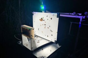
Insect research is revolutionized by technology
New technologies can revolutionise insect research and environmental monitoring. By using DNA, images, sounds and flight patterns analysed by AI, it’s possible to gain new insights into the world of…
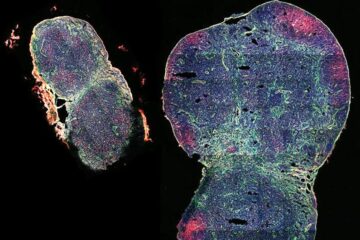
Expanding a lymph node, boosting a vaccine
A biomaterial vaccine enhances and sustains lymph node expansion following vaccination, boosting anti-tumor immunity in an animal model. Each one of us has around 600 lymph nodes (LNs) – small,…
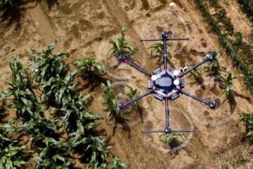
AI to Make Crop Production More Sustainable
Drones monitoring fields for weeds and robots targeting and treating crop diseases may sound like science fiction but is actually happening already, at least on some experimental farms. Researchers from…

