NASA Satellite sees two 'tropical fists' threatening Australia
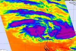
On Feb. 15 at 06:17 UTC (1:17 a.m. EST) AIRS instrument infrared data showed three areas of strong convection (purple) in System 97S. There are three areas of strong thunderstorms and convection (purple) where cloud top temperatures were so high in the atmosphere that they were as cold as or colder than -52 Celsius/-63 Fahrenheit. Credit: NASA JPL, Ed Olsen<br>
System 97S was located about 210 nautical miles north-northwest of Learmonth, Western Australia, at 1800 UTC (1 p.m. EST), Feb. 15. It was centered near 19.2 South and 112.1 East. That puts the center of System 97S well to the northwest of Exmouth. System 97S is forecast to move west or southwest over the next few days.
NASA's Atmospheric Infrared Sounder (AIRS) instrument captured infrared satellite data of System 97S on Feb. 15 at 06:17 UTC (1:17 a.m. EST). AIRS flies onboard NASA's Aqua satellite and the data showed three areas of strong convection in the low pressure area. Those areas of convection appear to be consolidating. Water vapor imagery confirmed that System 97S has rapidly consolidated in the 12 hours before and showed banding of thunderstorms around the southern edge of the center of circulation.
Maximum sustained winds are estimated between 20-25 knots (23 to 29 mph/37 to 46 kmh) and minimum sea level pressure at 1003 millibars.
A Cyclone Watch has been declared for coastal areas from Onslow to Coral Bay. Strong Wind Warnings are in effect from Wallal to Barrow Island, Barrow Island to Northwest Cape, and Northwest Cape to Coral Bay.
The Joint Typhoon Warning Center gives System 97S a good chance of becoming a tropical depression in the next 24 hours. Forecasts currently keep System 97S away from land over the next three days.
For more information about System 99S, visit: www.nasa.gov/hurricane.
Media Contact
All latest news from the category: Earth Sciences
Earth Sciences (also referred to as Geosciences), which deals with basic issues surrounding our planet, plays a vital role in the area of energy and raw materials supply.
Earth Sciences comprises subjects such as geology, geography, geological informatics, paleontology, mineralogy, petrography, crystallography, geophysics, geodesy, glaciology, cartography, photogrammetry, meteorology and seismology, early-warning systems, earthquake research and polar research.


Newest articles
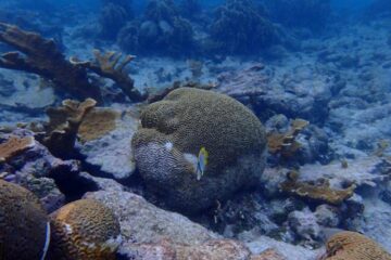
Stony coral tissue loss disease
… is shifting the ecological balance of Caribbean reefs. The outbreak of a deadly disease called stony coral tissue loss disease is destroying susceptible species of coral in the Caribbean…
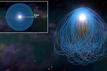
Hungry, hungry white dwarfs
… solving the puzzle of stellar metal pollution. Dead stars known as white dwarfs, have a mass like the Sun while being similar in size to Earth. They are common…

Web platform and app aim to improve quality of life for people with Parkinson’s disease
Parkinson’s disease is one of the most prevalent neurodegenerative conditions. It causes motor impairments such as tremors, slow movement, muscle stiffness, and balance problems. The individual course of the disease…

