NASA Sees System 91B Lingering over Southwestern India
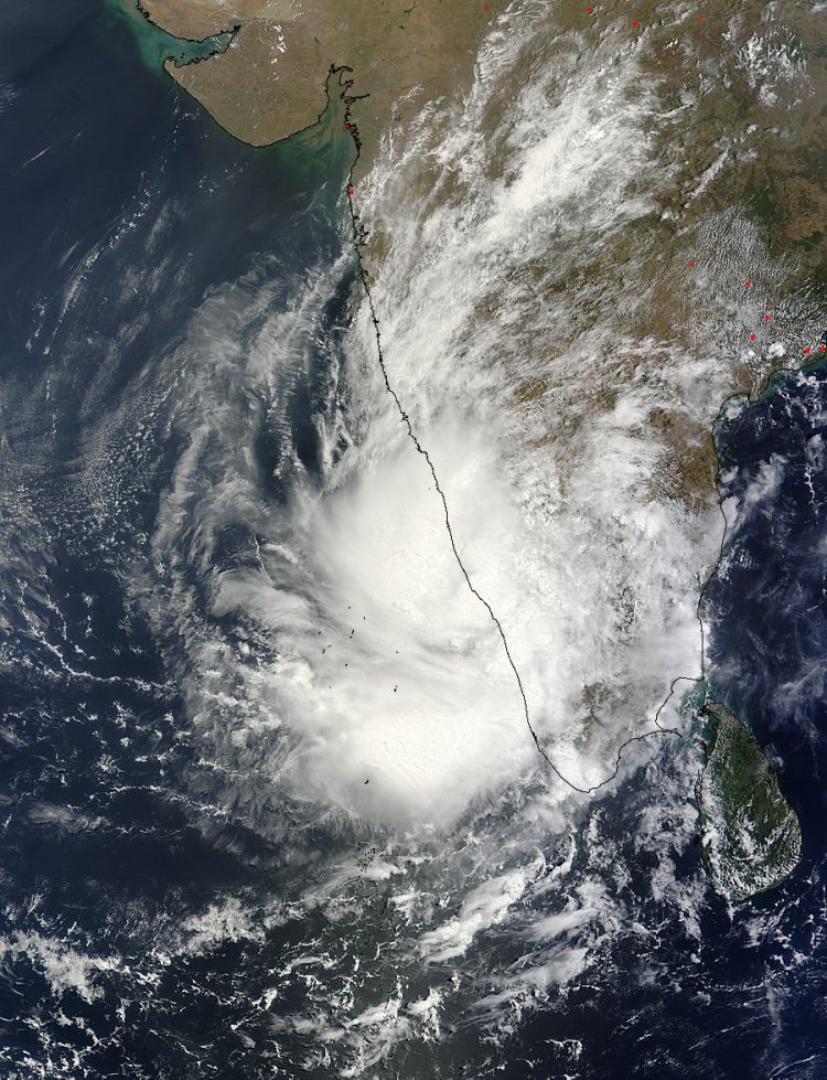
NASA's Terra satellite passed over System 91B over southwestern India and the MODIS instrument captured this visible image on May 8 at 05:40 UTC. Image Credit: NASA Goddard MODIS Rapid Response Team
NASA's Terra satellite passed over System 91B over southwestern India and the Moderate Resolution Imaging Spectroradiometer (MODIS) instrument captured a visible image on May 8 at 05:40 UTC/1:40 a.m. EDT.
The despite having a poorly defined low-level circulation center on infrared imagery, the circulation is visible in the MODIS image. The MODIS image shows that the eastern quadrant of the broad tropical low pressure system remains over southwestern India, while the western quadrant extends into the Northern Indian Ocean. The thunderstorms are fragmented in the low pressure area.
The Joint Typhoon Warning Center (JTWC) estimates that the low-level center of System 91B is near 10.1 north latitude and 76.4 east longitude, just 20 nautical miles (23.0 miles/37.0 km) north-northeast of Cochin, India.
The center of the storm has moved to the north over the last day and is about 15 nautical miles (17.2 miles/27.8 km) closer to Cochin than it was on May 7, indicating that it is a very slow moving system.
On May 8, JTWC's website noted “upper-level analysis (of the atmosphere) indicates a marginal environment with moderate, easterly vertical wind shear offset by strong diffluence (upper air flowing off or away from the center of the storm).
Maximum sustained surface winds are estimated between 10 to 15 knots (11.5 to 17.2 mph/18.5 to 27.7 kph) as they were on May 7, so the winds have not weakened. Minimum sea level pressure is estimated to be near 1006 millibars.
As System 91B continues to linger over land, it continues to have a low chance for developing into a significant tropical cyclone within the next 24 hours.
Text credit: Rob Gutro
NASA's Goddard Space Flight Center
Media Contact
All latest news from the category: Earth Sciences
Earth Sciences (also referred to as Geosciences), which deals with basic issues surrounding our planet, plays a vital role in the area of energy and raw materials supply.
Earth Sciences comprises subjects such as geology, geography, geological informatics, paleontology, mineralogy, petrography, crystallography, geophysics, geodesy, glaciology, cartography, photogrammetry, meteorology and seismology, early-warning systems, earthquake research and polar research.


Newest articles

Sea slugs inspire highly stretchable biomedical sensor
USC Viterbi School of Engineering researcher Hangbo Zhao presents findings on highly stretchable and customizable microneedles for application in fields including neuroscience, tissue engineering, and wearable bioelectronics. The revolution in…

Twisting and binding matter waves with photons in a cavity
Precisely measuring the energy states of individual atoms has been a historical challenge for physicists due to atomic recoil. When an atom interacts with a photon, the atom “recoils” in…

Nanotubes, nanoparticles, and antibodies detect tiny amounts of fentanyl
New sensor is six orders of magnitude more sensitive than the next best thing. A research team at Pitt led by Alexander Star, a chemistry professor in the Kenneth P. Dietrich…

