Tropical Storm Conson forms in northwestern Pacific

Conson, known locally in the Philippines as “Tropical Storm Basyang,” was about 400 nautical miles east of Manila, Philippines, near 14.4 North and 127.1 East at 1500 UTC (11 a.m. EDT). Conson has maximum sustained winds near 60 knots (69 mph) with higher gusts. Although Tropical Storm Conson is moving west near 14 knots (16 mph) it is forecast to track north-northwest over the next couple of days, and is expected to make landfall on July 13 after 1200 Zulu Time (8 a.m. EDT or 8 p.m. local Asia/Manila time).
The Philippine Atmospheric Geophysical and Astronomical Services Administration known as PAGASA posts forecasts and watches and warnings for residents of the Philippines.
Signal Warnings have been posted by PAGASA for various areas in Luzon, the Philippines. Signal No. 2 has been posted in Luzon for the following areas: Catanduanes, Camarines Norte, Polillo Island, Aurora, Quirino and Isabela. Signal 2 means winds are expected between 60-100 kph (37-62 mph).
A Signal No. 1 alert indicates expected winds between 30-60 kph (18-37 mph). A Signal 1 is in effect in Luzon for the areas of: Camarines Sur, Albay, Quezon, Rizal, Bulacan, Nueva Ecija, Nueva Vizcaya, Ifugao, Benguet, Mt. Province, Kalinga, and Cagayan. Residents living in low lying and mountainous areas under signals # 1 and 2 are alerted against possible flashfloods and landslides. For updated watches and warnings, visit: http://www.pagasa.dost.gov.ph/wb/tc_up.html.
PAGASA indicated that by Tuesday evening (local Asia/Manila time) the center of Conson (or Basyang) should be located about 90 km (55 miles) east of Casiguran, Aurora and is expected to make landfall before midnight (local time). By Wednesday evening, July 14, Conson's (Basyang) center is expected to be about 120 km (74 miles) west-Southwest of Laoag City.
Microwave satellite imagery on July 12 (today) indicated a low-level eye feature, a sign that Tropical Storm Conson may be strengthening into a Cyclone. Even though today's visible image captured by the Moderate Resolution Imaging Spectroradiometer (that flies aboard NASA's Aqua satellite) did not show an eye, it was likely because the upper levels of Conson's center were obscured by high clouds.
Forecasters at the Joint Typhoon Warning Center indicate that Conson will continue to strengthen because it is in an area with low vertical wind shear (winds that can tear a storm apart if strong enough) and warm sea surface temperatures (that power cyclones).
Media Contact
More Information:
http://www.nasa.govAll latest news from the category: Earth Sciences
Earth Sciences (also referred to as Geosciences), which deals with basic issues surrounding our planet, plays a vital role in the area of energy and raw materials supply.
Earth Sciences comprises subjects such as geology, geography, geological informatics, paleontology, mineralogy, petrography, crystallography, geophysics, geodesy, glaciology, cartography, photogrammetry, meteorology and seismology, early-warning systems, earthquake research and polar research.
Newest articles

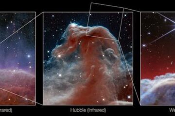
Webb captures top of iconic horsehead nebula in unprecedented detail
NASA’s James Webb Space Telescope has captured the sharpest infrared images to date of a zoomed-in portion of one of the most distinctive objects in our skies, the Horsehead Nebula….

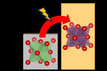
Cost-effective, high-capacity, and cyclable lithium-ion battery cathodes
Charge-recharge cycling of lithium-superrich iron oxide, a cost-effective and high-capacity cathode for new-generation lithium-ion batteries, can be greatly improved by doping with readily available mineral elements. The energy capacity and…

Novel genetic plant regeneration approach
…without the application of phytohormones. Researchers develop a novel plant regeneration approach by modulating the expression of genes that control plant cell differentiation. For ages now, plants have been the…


