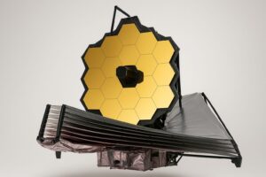
Feeding 9 Billion: Innovations in Agricultural Modeling
Satellite images have revealed the collapse of Larsen B ice shelf on the Antarctic Peninsula fulfilling predictions made by British Antarctic Survey (BAS) scientists. The collapse of the 3250 km2 ice shelf is the latest drama in a region of Antarctica that has experienced unprecedented warming over the last 50 years.
Earlier this month Ted Scambos of the University of Colorado alerted BAS glaciologists David Vaughan and Chris Doake to images from the NASA MODIS satellite. Meanwhile, in Antarctica Argentinian glaciologist Pedro Skvarca, realised something was happening to the ice shelf and mobilised an aircraft to obtain aerial images confirming the satellite data. While the collapse was still occurring the BAS research ship RRS James Clark Ross navigated her way through the armada of icebergs to obtain photographs and samples.
Over the last month the 200-m thick ice shelf collapsed into small icebergs and fragments. Pooling these new observations scientists will determine when such an event last happened and which ice shelves are threatened in future.
BAS glaciologist Dr David Vaughan said,
“In 1998, BAS predicted the demise of more ice shelves around the Antarctic Peninsula. Since then warming on the peninsula has continued and we watched as piece-by-piece Larsen B has retreated. We knew what was left would collapse eventually, but the speed of it is staggering. Hard to believe that 500 million billion tonnes of ice sheet has disintegrated in less than a month.”




Earthquakes in the American state of Utah, the Soultz-sous-Forêts region of France or in the Dutch province of Groningen should not be able to occur even if the subsurface has been exploited for decades. This is because the shallow subsurface behaves in such a way that faults there become stronger as soon as they start moving. At least that is what geology textbooks teach us. And so, in theory, it should not be possible for earthquakes to occur. So why…
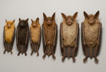
Just in time for Halloween, researchers from the Royal Ontario Museum (ROM), the Field Museum in Chicago, and Lawrence University in Wisconsin have announced the discovery of six new species of bats. These newly identified species, all found in the Philippines, belong to the group known as tube-nosed bats—a fascinating and diverse branch of the mammal family tree. Expanding the Tree of Life Formally recognized as new species through morphological and genetic analysis, this discovery expands the already impressive global…
In a recent study published today in the European Geosciences Union (EGU) journal Biogeosciences, scientists have confirmed that mercury pollution from artisanal and small-scale gold mining (ASGM) is contaminating food crops not through the soil, as previously believed, but directly from the air. Driven by the surging price of gold, which has increased by more than tenfold since 2000, the rapid expansion of unregulated mining in these regions raises urgent questions about food security, human health, and environmental justice The…
A new study from Iceland’s Surtsey island shows that birds carried most of the plants that colonised the island, challenging long-held beliefs that seed or fruit shape determines how plants spread — offering fresh insight into life’s adaptation to c When the volcanic island of Surtsey rose from the North Atlantic Ocean in 1963, it offered scientists a once-in-a-lifetime opportunity to observe how life takes hold on a brand-new and barren land. For decades, ecologists believed that plants’ ability to…
 Feedback