


Feeding 9 Billion: Innovations in Agricultural Modeling
“At this point, our team is working almost around the clock to incorporate as much data and functionality as possible,” says Michael L. Pack, director of the University of Maryland’s Center for Advanced Transportation Technology Laboratory (CATT), part of the Clark School of Engineering.
The RITIS system fuses, translates, standardizes and redistributes vast amounts of real-time information obtained from multiple agencies in the region in order to provide an enhanced overall, real-time view, or digital map, of traffic and incident conditions across the region’s transportation network. It can present the data in both two and three-dimensional graphical formats, creating a life-like simulation and display.
The system was originally developed to coordinate traffic-related information, but the CATT lab is now working to build-in additional data sources from public safety agencies, transit groups, weather data, and numerous other groups.
“We’re trying to visualize the real-time status of our transportation system – showing the real-world and providing situational awareness to decision makers – all on a single screen.” Pack says. “We’re enabling these many disparate systems to communicate with each other.”
The idea is to enhance officials’ ability to monitor vehicular traffic, accidents, incidents, response plans, air space, weather conditions and more – data that’s available, but until now could not be simultaneously displayed on a single platform or user interface.

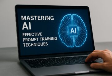
Research from Carnegie Mellon’s School of Computer Science suggests prompt engineering could be as important as coding Today’s generative artificial intelligence models can create everything from images to computer applications, but the quality of their output depends largely on the prompt a human user provides. Carnegie Mellon University researchers have proposed a new approach for teaching everyday users how to create these prompts and improving their interactions with generative artificial intelligence models. The method, called Requirement-Oriented Prompt Engineering (ROPE), shifts…

A new quantum random number generator is almost 1000 times faster than other generators and much smaller, promising to change data management and cybersecurity in several industries including health, finance, and defense A joint team of researchers led by scientists at King Abdullah University of Science and Technology (KAUST) and King Abdulaziz City for Science and Technology (KACST) has reported the fastest quantum random number generator (QRNG) to date based on international benchmarks. The QRNG, which passed the required randomness…

Very secure and highly efficient: encryption and decryption with luminescent perovskites To guarantee high data security, encryption must be unbreakable while the data remains rapidly and easily readable. A novel strategy for optical encryption/decryption of information has now been introduced in the journal Angewandte Chemie by a Chinese research team. It is based on compounds with carefully modulated luminescent properties that change in response to external stimuli. The compounds are hybrid two-dimensional organic-inorganic metal-halide perovskites, whose structure consists of inorganic…

Researchers at the University of Utah’s Department of Psychiatry and Huntsman Mental Health Institute today published a paper introducing RiskPath, an open source software toolkit that uses Explainable Artificial Intelligence (XAI) to predict whether individuals will develop progressive and chronic diseases years before symptoms appear, potentially transforming how preventive healthcare is delivered. XAI is an artificial intelligence system that can explain complex decisions in ways humans can understand. The new technology represents a significant advancement in disease prediction and prevention…
