


Feeding 9 Billion: Innovations in Agricultural Modeling
The first 3D maps of the UK underworld are to be created in a new £2.2m project which will save the UK millions of pounds by reducing the amount we dig up our roads.
There are enough pipes and cables buried under our streets to stretch to the moon and back ten times, but we don’t know where many of them are. Researchers from the Universities of Leeds and Nottingham will help to locate them, by finding a way to integrate existing digital and paper-based records and link these with data from satellite and ground-based positioning systems.
They aim to bring all this information together in a format that’s easy to understand for contractors, utility companies and planners – so it can be displayed visually on a PC in the office or handheld unit in the street.
Four million holes are dug each year in the nation’s road – one every seven seconds – to repair pipes and cables or install new ones, at an estimated cost of £1bn per annum. With indirect costs, such as congestion, this rises to an estimated £5bn p.a. – over £80 for every inhabitant of the UK.
By creating more accurate information, the project will help reduce the numbers of holes dug, ensure they are dug in the right place and that unexpected pipes and cables aren’t damaged in the process. Reducing roadworks by just 0.1% would save the UK economy millions of pounds a year.
Announcing £900,000 funding for the research from the DTI’s Technology Programme, Minister for Science and Innovation, Lord Sainsbury, heralded the project as ‘world beating’ and said it would help ‘develop a competitive advantage for British business’.
Leading the research at Leeds is Professor of Automated Reasoning, Tony Cohn. He said: “We’ll always need to dig holes in the street, but reducing the amount of roadworks would bring enormous economic and environmental benefits, with fewer traffic jams and exhaust emissions. From a human point of view, we also hope to reduce the number of fatalities and injuries every year from accidental hits on gas pipes and electrical cables.
“Many of the country’s underground pipes were laid in the 19th and early 20th century, when it wasn’t seen as important to keep accurate records of location and depth. Even where we have records, many are now very inaccurate, as reference points such as kerbs or buildings have moved or been demolished. And because each company has their own records there’s no easy way of providing an integrated view. Our aim is to create the technology to enable the construction of a dynamic map of all the UK’s underground assets.”
One of the challenges facing the researchers is to create a centimetre-accurate satellite-based location technology which can work even in ‘urban canyons’ to record in-street observations. Another challenge is linking these recordings to existing information held by each utility, to create a complete picture of what lies underground. The final step will be ensuring this information is provided to those who need it in a form that is accessible and comprehensible.
The research is being led by the University of Leeds, in collaboration with the University of Nottingham and 19 companies and organisations from the utilities, transport and engineering sectors and managed by UKWIR (UK Water Industry Research Ltd).

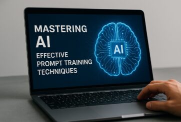
Research from Carnegie Mellon’s School of Computer Science suggests prompt engineering could be as important as coding Today’s generative artificial intelligence models can create everything from images to computer applications, but the quality of their output depends largely on the prompt a human user provides. Carnegie Mellon University researchers have proposed a new approach for teaching everyday users how to create these prompts and improving their interactions with generative artificial intelligence models. The method, called Requirement-Oriented Prompt Engineering (ROPE), shifts…
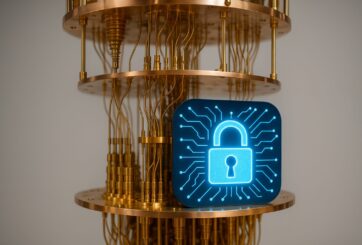
A new quantum random number generator is almost 1000 times faster than other generators and much smaller, promising to change data management and cybersecurity in several industries including health, finance, and defense A joint team of researchers led by scientists at King Abdullah University of Science and Technology (KAUST) and King Abdulaziz City for Science and Technology (KACST) has reported the fastest quantum random number generator (QRNG) to date based on international benchmarks. The QRNG, which passed the required randomness…

Very secure and highly efficient: encryption and decryption with luminescent perovskites To guarantee high data security, encryption must be unbreakable while the data remains rapidly and easily readable. A novel strategy for optical encryption/decryption of information has now been introduced in the journal Angewandte Chemie by a Chinese research team. It is based on compounds with carefully modulated luminescent properties that change in response to external stimuli. The compounds are hybrid two-dimensional organic-inorganic metal-halide perovskites, whose structure consists of inorganic…

Researchers at the University of Utah’s Department of Psychiatry and Huntsman Mental Health Institute today published a paper introducing RiskPath, an open source software toolkit that uses Explainable Artificial Intelligence (XAI) to predict whether individuals will develop progressive and chronic diseases years before symptoms appear, potentially transforming how preventive healthcare is delivered. XAI is an artificial intelligence system that can explain complex decisions in ways humans can understand. The new technology represents a significant advancement in disease prediction and prevention…
