


Feeding 9 Billion: Innovations in Agricultural Modeling
Getting lost in strange towns and cities or trying to find the right way to a particular destination is no longer a problem due to new navigation software that provides on the move information for drivers and pedestrians within seconds.
Developed with the help of almost £1.3 million from the Information Society Technology (IST) Programme of the European Union’s Framework Programme, PEPTRAN gives drivers and mobile users information on the best possible routes within seconds, using their smartphones or a navigation system installed in their cars.
“This will provide major benefits – particularly for tourists, professional drivers and possibly for car-sharing and rental services that are looking to improve their services for clients”, says project Manager Rory Doyle from UK partner British Maritime Technology. “Users simply enter basic information about their journey and our innovative route navigation software tells them the easiest way to get there either by car, public transport or on foot – or by using a combination of them.”
Peter Walters, UK National Contact Point for IST within the EU’s Sixth Framework Programme, added “This project has made the best possible use of Framework funding – the EU’s main method of providing funding for collaborative research and innovation – to develop something that will be useful to us all. Not everyone is comfortable reading a map and even those who can will have first hand experience of how difficult and often time-consuming it can be trying to use paper maps and timetables on the move. I am also hopeful that PEPTRAN will help reduce congestion, as people trying the system for the first time admitted that they were more inclined use local public transport instead of using their own cars.”
By inputting the date and time of the journey and start and end locations (street names or coordinates, if known) into their mobile or car navigation devices PEPTRAN uses the information gathered from existing street navigation systems, cars and public transport servers to supply the route-plan. This information takes account of public transport timetables, the real-time progress of public transport vehicles or guidelines to a particular route and how to get there. It also tells the user how and where to change buses to minimise the total journey time.
Car drivers are directed to the nearest parking space before using public transport in an attempt to avoid city traffic. In both car navigation and mobile options, information is presented to the user by means of maps or simple text directions.
As time becomes more constrained and transport needs are increasing, the new technology will in the future give Europeans a seriously convincing reason for opting for their local bus or train.

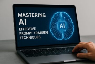
Research from Carnegie Mellon’s School of Computer Science suggests prompt engineering could be as important as coding Today’s generative artificial intelligence models can create everything from images to computer applications, but the quality of their output depends largely on the prompt a human user provides. Carnegie Mellon University researchers have proposed a new approach for teaching everyday users how to create these prompts and improving their interactions with generative artificial intelligence models. The method, called Requirement-Oriented Prompt Engineering (ROPE), shifts…

A new quantum random number generator is almost 1000 times faster than other generators and much smaller, promising to change data management and cybersecurity in several industries including health, finance, and defense A joint team of researchers led by scientists at King Abdullah University of Science and Technology (KAUST) and King Abdulaziz City for Science and Technology (KACST) has reported the fastest quantum random number generator (QRNG) to date based on international benchmarks. The QRNG, which passed the required randomness…

Very secure and highly efficient: encryption and decryption with luminescent perovskites To guarantee high data security, encryption must be unbreakable while the data remains rapidly and easily readable. A novel strategy for optical encryption/decryption of information has now been introduced in the journal Angewandte Chemie by a Chinese research team. It is based on compounds with carefully modulated luminescent properties that change in response to external stimuli. The compounds are hybrid two-dimensional organic-inorganic metal-halide perovskites, whose structure consists of inorganic…

Researchers at the University of Utah’s Department of Psychiatry and Huntsman Mental Health Institute today published a paper introducing RiskPath, an open source software toolkit that uses Explainable Artificial Intelligence (XAI) to predict whether individuals will develop progressive and chronic diseases years before symptoms appear, potentially transforming how preventive healthcare is delivered. XAI is an artificial intelligence system that can explain complex decisions in ways humans can understand. The new technology represents a significant advancement in disease prediction and prevention…
