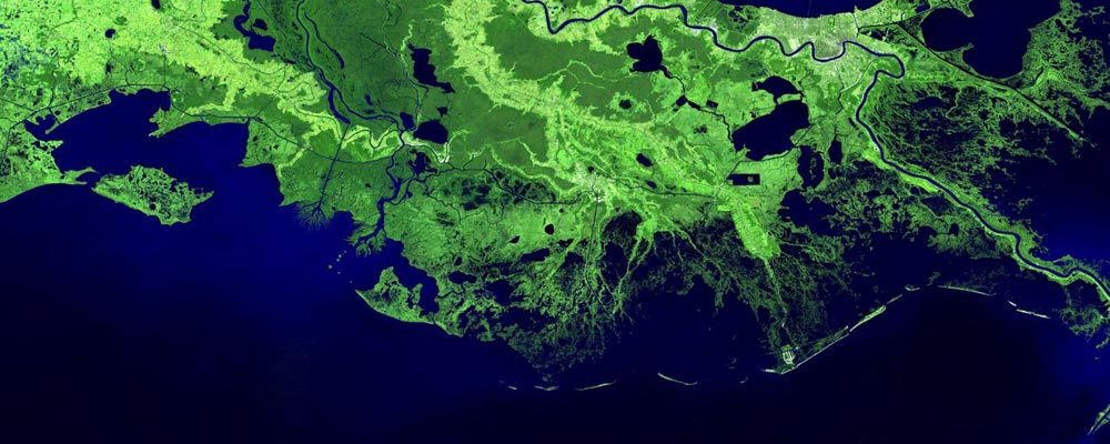

This is a satellite image of coast at Mississippi Delta.
Credit: Indiana University
Wind-driven expansion of marsh ponds on the Mississippi River Delta is a significant factor in the loss of crucial land in the Delta region, according to research published by scientists at Indiana University and North Carolina State University.
The study found that 17 percent of land loss in the area resulted from pond expansion, much of it caused by waves that eroded away the edges of the pond.
The findings add to scientists' understanding of the processes that shape the Delta and present new challenges for scientists and engineers seeking ways to protect sensitive coastlines.
“The Mississippi Delta is undergoing collapse as land disappears from the coast and marshes,” said study co-author Douglas Edmonds, assistant professor and the Malcolm and Sylvia Boyce Chair in the Department of Earth and Atmospheric Sciences at IU Bloomington. “Yet we know surprisingly little about what processes are driving land loss.”
River deltas are ecologically important and highly productive, and they are home to about 5 percent of the world's population. Under naturally occurring processes, coastal land is created in deltas when river sediment is deposited. But sea-level rise and human engineering of river channels have starved the Mississippi Delta of sediment, creating widespread land loss. Any hope of reversing the trend, Edmonds said, requires a clear understanding of the processes at work.
To conduct the study, the researchers analyzed satellite images taken from 1982 to 2016 across the Delta.
“In total, we looked at 10,000 images and classified approximately 1.29 billion pixels into land or water,” said Samapriya Roy, a doctoral student at IU in geography and another co-author on the paper. “To do this we took advantage of the supercomputing resources at Indiana University.”
Much of the pond expansion the researchers observed was in a southwesterly direction, driven by prevailing winds from the northeast. Expansion was significantly greater in ponds larger than 300 meters in diameter, where larger waves were more likely to erode the edges.
“Our analysis shows that ponds across the deltaic plain are moving and expanding in the same direction as the wind,” said Alejandra Ortiz, the study's lead author and an assistant professor of civil, construction and environmental engineering at North Carolina State University. “That such evidence emerged over this expansive study area was surprising, because we thought sea-level rise would be the dominant control on pond expansion. We were also surprised by how important pond expansion is to total land loss on the Mississippi River Delta.”
The study points to the importance of river-borne sediment. Because scientists thought sea-level rise and storm surges were dominant threats to coastlines, coastal protection has largely focused on building walls, embankments and other structures to combat rising seas and adding land to replace what's lost or left underwater. But the expansion of ponds would take place even if sea levels weren't rising.
“Most current restoration strategies call for diverting sediment to the coastline where rising sea level is a threat,” Edmonds said. “Our work points out that sediment should also be diverted to marsh ponds to halt expansion.”
On the Mississippi, dams and flood-control barriers have changed the flow of the river and reduced the amount of sediment deposited at the Delta to replace land that is lost to flooding and erosion. But it's also possible to build diversions that direct river sediment to where it is needed.
“Restoring these pathways of sediment movement is key to reversing the trend of land loss,” Edmonds said. “Sediment is a valuable resource in the Mississippi Delta, but unfortunately it is in short supply.”
###
The study was published in Geophysical Research Letters and funded by the National Science Foundation.


