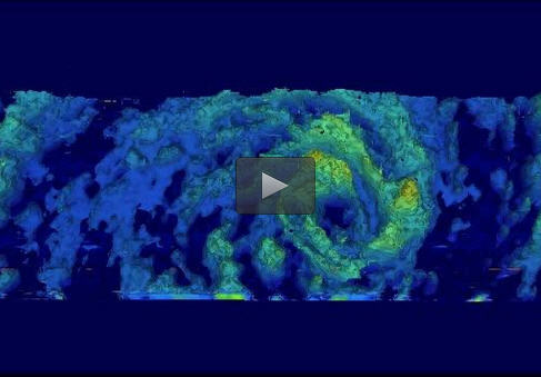

On Jan. 28, GPM's Microwave Imager found that rain was falling at a rate of only 30.2 mm (about 1.2 inches) per hour in storms around Eunice's eye. Image Credit: NASA/JAXA/SSAI, Hal Pierce
Tropical cyclone Eunice became the fourth tropical cyclone of the 2015 Southern Indian Ocean season when it formed well east of Madagascar on January 27, 2014.
The Global Precipitation Measurement or GPM core satellite flew directly over the eye of Tropical Cyclone Eunice on January 28, 2015 at 1049 UTC (5:49 a.m. EST). GPM's Microwave Imager (GMI) found that rain was falling at a rate of only 30.2 mm (about 1.2 inches) per hour in storms around Eunice's eye. GPM's Radar (Ku band) was used in a 3-D view to show vertical structure of precipitation within the tropical cyclone. The data showed the highest thunderstorm heights reached heights of close to 14km (8.7 miles).
On Jan. 29, 2015, the RapidScat instrument that flies aboard the International Space Station scanned Tropical Cyclone Eunice from 12:38 UTC to 14:11 UTC gathering wind speed data. RapidScat showed that the strongest winds were occurring on the southwestern quadrant of the storm at a rate of 25 to 30 meters per second (55.9 to 67.1 mph/90 to 108 kph).
NASA's Terra satellite flew over Tropical Cyclone Eunice and the Moderate Resolution Imaging Spectroradiometer or MODIS instrument aboard captured a clear visible image of its tiny 6 nautical-mile (6.9 miles/11.1 km) wide eye on Jan. 30 at 05:30 UTC.
At 1500 UTC (10 a.m. EST), Tropical Cyclone Eunice was a major hurricane with maximum sustained winds up to 140 knots (161.1 mph/259.3 kph). It was centered near 19.5 south latitude and 68.9 east longitude, about 763 nautical miles (878 miles/1,413 km) south-southwest of Diego Garcia. Eunice is moving south-southeast at 9 knots (10.3 mph/ 16.67 kph).
Eunice is expected to begin weakening after today as it moves into cooler sea surface temperatures and encounters strong vertical wind shear. The Joint Typhoon Warning Center forecast indicates that the storm will weaken to an extra-tropical storm by February 3 over open waters of the Southern Indian Ocean.
GPM is a joint mission between NASA and the Japan Aerospace Exploration Agency called JAXA.
The ISS-RapidScat instrument flies aboard the International Space Station and measures Earth's ocean surface wind speed and direction. ISS-RapidScat images are created by Analyst Doug Tyler at NASA's Jet Propulsion Laboratory (JPL) in Pasadena, California. NASA JPL manages ISS-RapidScat.
Hal Pierce/Rob Gutro
SSAI/NASA's Goddard Space Flight Center


