cean surface saltiness influences el nino forecasts
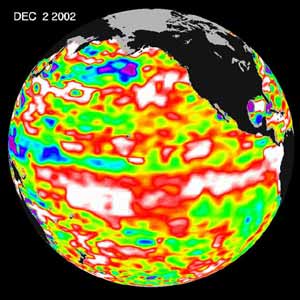
NASA sponsored scientists have discovered by knowing the salt content of the ocean’s surface, they may be able to improve the ability to predict El Nino events. Scientists, studying the western Pacific Ocean, find regional changes in the saltiness of surface ocean water correspond to changes in upper ocean heat content in the months preceding an El Nino event. Knowing the distribution of surface salinity may help predict events.
Salinity and temperature combine to dictate the ocean’s density. Greater salinity, like colder temperatures, results in an increase in ocean density with a corresponding depression of the sea surface height. In warmer, fresher waters, the density is lower resulting in an elevation of the sea surface. These ocean height differences are related to the circulation of the ocean.
The surface salinity in two regions contributes to El Nino events: an area of warmer temperatures and lower salinity in the western Pacific, and the higher salinity and cooler temperatures in the eastern Pacific. Differences in surface salinity are related to changes in temperature and upper ocean heat content, which are part of the El Nino phenomenon. They have the potential to influence the Earth’s climate through air-sea interaction at the ocean’s surface.
The study, conducted for NASA by University of Maryland researchers Joaquim Ballabrera, Tony Busalacchi, and Ragu Murtugudde, is one of the first to look at ocean salinity in El Nino, Southern Oscillation (ENSO) predictions and their relationship to tropical sea surface temperatures, sea level, winds, and fresh water from rain. Results of the study are in the latest issue of the Journal of Geophysical Research – Oceans.
Ballabrera and his colleagues looked at data, from 1980 to 1995, about sea surface temperatures, winds, rainfall, evaporation, sea surface height, and latent heat, the energy released when water vapor condenses into droplets.
Using computer models, they performed a series of statistical predictions of the El Nino events for such a period. The results indicate short-term predictions only require monitoring sea surface temperatures, while predictions over a season require the observation of sea level. They concluded observations of salinity significantly improve predictions. When changes in salinity occur, they affect the El Nino event for the next six to 12 months. In this lag time, salinity changes have the potential to modify the layers of the ocean and affect the heat content of the western Pacific Ocean; the region where the unusual atmospheric and oceanic behavior associated to El Nino first develops. “As a result, when changes in ocean saltiness are considered, improvements are found in El Nino forecasts six to 12 months in advance,” Ballabrera said.
“This research holds tremendous potential for the NASA Aquarius mission to monitor the surface salinity of the global ocean,” Busalacchi said. Aquarius is scheduled for launch during 2006-2007. Aquarius will provide the first global maps of salt concentration on the ocean surface. Salt concentration is a key area of scientific uncertainty in the oceans’ capacity to store and transport heat, which in turn affects Earth’s climate and water cycle.
By using remote sensing data from satellites, scientists will be able to see changes in ocean salinity. Knowing the lag time factor, computer models simulating the movement of the atmosphere may be able to accurately predict El Nino episodes. This may lead to longer lead-time for predictions of ENSO events.
Florida State University, the National Center for Environmental Prediction, National Center for Atmospheric Research and the Etudes Climatiques de l’Ocean Pacifique tropical program at Institut de Recherche pour le Developpement, Centre de Noumea contributed ocean and atmosphere data to this study.
The National Oceanic and Atmospheric Administration’s El Nino Web Page:
http://www.pmel.noaa.gov/tao/elNino /Nino -home-low.html
Media Contact
All latest news from the category: Earth Sciences
Earth Sciences (also referred to as Geosciences), which deals with basic issues surrounding our planet, plays a vital role in the area of energy and raw materials supply.
Earth Sciences comprises subjects such as geology, geography, geological informatics, paleontology, mineralogy, petrography, crystallography, geophysics, geodesy, glaciology, cartography, photogrammetry, meteorology and seismology, early-warning systems, earthquake research and polar research.


Newest articles

Superradiant atoms could push the boundaries of how precisely time can be measured
Superradiant atoms can help us measure time more precisely than ever. In a new study, researchers from the University of Copenhagen present a new method for measuring the time interval,…

Ion thermoelectric conversion devices for near room temperature
The electrode sheet of the thermoelectric device consists of ionic hydrogel, which is sandwiched between the electrodes to form, and the Prussian blue on the electrode undergoes a redox reaction…

Zap Energy achieves 37-million-degree temperatures in a compact device
New publication reports record electron temperatures for a small-scale, sheared-flow-stabilized Z-pinch fusion device. In the nine decades since humans first produced fusion reactions, only a few fusion technologies have demonstrated…

