NASA sees Tropical Storm Linfa exiting northern Philippines
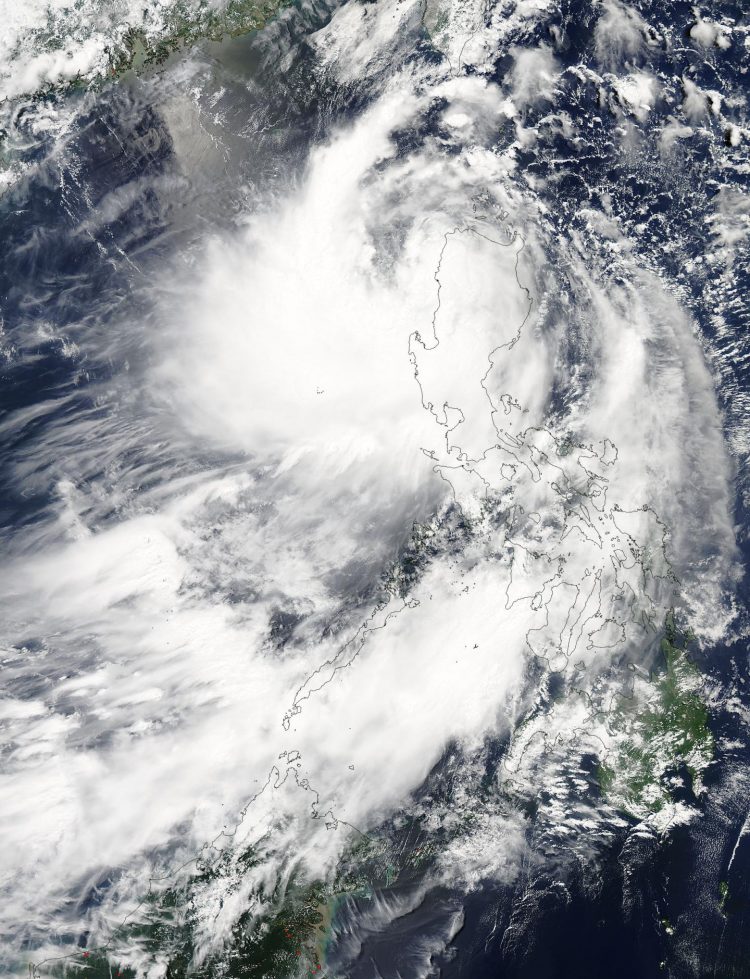
On July 5 at 05:25 UTC (1:25 a.m. EDT) the MODIS instrument aboard NASA's Aqua satellite captured this image or Tropical Storm Linfa moving into the South China Sea. Credits: NASA Goddard MODIS Rapid Response Team
On July 5 at 05:25 UTC (1:25 a.m. EDT) the MODIS (Moderate Resolution Imaging Spectroradiometer) instrument aboard NASA's Aqua satellite captured a visible image or Tropical Storm Linfa moving into the South China Sea.
The storm appeared to be somewhat elongated because of wind shear and had weakened as a result of moving over land. MODIS imagery also showed an isolated area of deep convection, thunderstorms and clouds, pushed over the southwest quadrant of the low-level center, as a result of northeasterly wind shear.
The Joint Typhoon Warning Center noted that animated multispectral satellite imagery showed that the low-level center of circulation is exposed to outside winds.
Tropical Storm Linfa was about 295 nautical miles (339 miles/1,639 km) north-northwest of Manila, Philippines. It was centered near 19.2 North latitude and 119.2 East longitude. Tropical Storm Linfa has maximum sustained winds near 45 knots (51.7 mph/83.3 kph). It was moving to the north at 5 knots (5.7 mph/9.6 kph).
As Linfa continues to exit the northern Philippines, some warnings remained in effect for July 5. Public storm warning signal #2 remained in effect in the Luzon provinces of Batanes, Cagayan including Calayan and Babuyan group of Islands, Apayao, Kalinga, Ilocos Norte, Ilocos Sur and Abra. In addition Public storm warning signal #1 remained in effect in the Luzon provinces of Pangasinan, Isabela, Benguet, La Union, Mt. Province and Ifugao.
Linfa is moving north and is forecast to then curve northwest and move between Taiwan and mainland China by July 9. The Joint Typhoon Warning Center expects Linfa to strengthen a little before wind shear brings about its dissipation in the Taiwan Strait sometime around July 10.
Media Contact
All latest news from the category: Earth Sciences
Earth Sciences (also referred to as Geosciences), which deals with basic issues surrounding our planet, plays a vital role in the area of energy and raw materials supply.
Earth Sciences comprises subjects such as geology, geography, geological informatics, paleontology, mineralogy, petrography, crystallography, geophysics, geodesy, glaciology, cartography, photogrammetry, meteorology and seismology, early-warning systems, earthquake research and polar research.


Newest articles

A new look at the consequences of light pollution
GAME 2024 begins its experiments in eight countries. Can artificial light at night harm marine algae and impair their important functions for coastal ecosystems? This year’s project of the training…

Silicon Carbide Innovation Alliance to drive industrial-scale semiconductor work
Known for its ability to withstand extreme environments and high voltages, silicon carbide (SiC) is a semiconducting material made up of silicon and carbon atoms arranged into crystals that is…

New SPECT/CT technique shows impressive biomarker identification
…offers increased access for prostate cancer patients. A novel SPECT/CT acquisition method can accurately detect radiopharmaceutical biodistribution in a convenient manner for prostate cancer patients, opening the door for more…

