NASA Satellite Catches Australia's Newborn Tropical Storm Edna and Stubborn Fletcher
This infrared image of Tropical Storm Edna was taken by NOAA's polar orbiting satellite, NOAA-19 on Feb. 4 at 1443 UTC/9:43 a.m. <br>Image Credit: NRL/NOAA<br>
On February 3 at 15:53 UTC/10:53 a.m. EST, NASA's Aqua satellite passed over Queensland, Australia and the AIRS or Atmospheric Infrared Sounder instrument captured infrared data on both storms. System 94P/Fletcher was in the Gulf of Carpentaria and over the Northwest region of Queensland, while newborn Edna formed in the South Pacific Ocean east of Queensland.
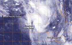
Tropical Storm Edna Moving Toward New Caledonia
System 93P strengthened between February 3 and 4 into Tropical Depression 12P and then Tropical Storm Edna, northwest New Caledonia. By 1500 UTC/10 a.m. EST Edna was about 392 nautical miles northwest of New Caledonia, near 17.2 south latitude and 161.5 east longitude. Edna had maximum sustained winds near 35 knots/40 mph/62 kph. It was moving to the southeast at 19 knots/21.8 mph/35.1 kph.
NASA's AIRS data showed very cold cloud top temperatures in powerful thunderstorms within Edna that have the potential for heavy rainfall. Infrared data also showed that Edna's circulation has consolidated and convection has deepened/strengthened with bands of thunderstorms, mostly north of the center, were wrapping more tightly into the low-level center of circulation.
AIRS data also showed that sea surface temperatures were around 28C/82.4F, warm enough to contribute to strengthening the system. Sea surface temperatures need to be at least 26.6C/80F in order for a tropical cyclone to maintain intensity. Warmer temperatures than that can help in increased evaporation with the formation of thunderstorms that make up a tropical cyclone. However, as Edna continues tracking southward, the storm will run into cooler sea surface temperatures that will squelch any significant intensification.
Text credit: Rob Gutro
NASA's Goddard Space Flight Center
Media Contact
All latest news from the category: Earth Sciences
Earth Sciences (also referred to as Geosciences), which deals with basic issues surrounding our planet, plays a vital role in the area of energy and raw materials supply.
Earth Sciences comprises subjects such as geology, geography, geological informatics, paleontology, mineralogy, petrography, crystallography, geophysics, geodesy, glaciology, cartography, photogrammetry, meteorology and seismology, early-warning systems, earthquake research and polar research.


Newest articles

Combatting disruptive ‘noise’ in quantum communication
In a significant milestone for quantum communication technology, an experiment has demonstrated how networks can be leveraged to combat disruptive ‘noise’ in quantum communications. The international effort led by researchers…

Stretchable quantum dot display
Intrinsically stretchable quantum dot-based light-emitting diodes achieved record-breaking performance. A team of South Korean scientists led by Professor KIM Dae-Hyeong of the Center for Nanoparticle Research within the Institute for…

Internet can achieve quantum speed with light saved as sound
Researchers at the University of Copenhagen’s Niels Bohr Institute have developed a new way to create quantum memory: A small drum can store data sent with light in its sonic…

