NASA's Terra satellite sees Typhoon In-fa stretching
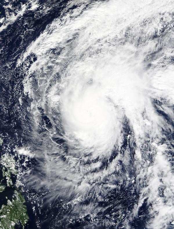
On Nov. 23 at 02:00 UTC the MODIS instrument aboard NASA's Terra satellite captured this image of Typhoon In-fa in the Pacific Ocean. Credits: NASA Goddard MODIS Rapid Response Team
On Nov. 23 at 02:00 UTC (Nov. 22 at 9 p.m. EST) the Moderate Resolution Imaging Spectroradiometer or MODIS instrument aboard NASA's Terra satellite captured an image of Typhoon In-fa in the Pacific Ocean.
In-fa's cloud-filled eye was surrounded by powerful thunderstorms. A large band of thunderstorms were wrapping into the low-level center in the northeastern quadrant, and stretching east.
Forecasters at the Joint Typhoon Warning Center noted that the system continues to be elongated to the northeast along the leading edge of an approaching mid-Latitude trough (elongated area of low pressure).
On Nov. 23 at 1500 UTC (10 a.m. EST), Typhoon In-fa had maximum sustained winds near 90 knots (103.6 mph/ 166.7 kph). Typhoon-force winds only extend nautical 25 miles (28.7 miles/46.3 km) from the center.
It was centered near 16.9 north latitude and 131.3 east longitude, about 734 nautical miles (844.7 miles/1,359 km) southwest of Iwo To, Japan.
In-fa was moving to the north-northwest at 4 knots (4.6 mph/7.4 kph) and is expected to curve to the northeast.
Environmental conditions are expected to continue to deteriorate as vertical wind shear rapidly increases due to the strong westerly winds from the approaching trough.
The Joint Typhoon Warning Center expects In-fa to weaken over the next couple of days and become an extra-tropical storm.
In-fa is forecast to approach the island of Iwo To, Japan on Nov. 26 and move in a northeasterly direction.
Media Contact
All latest news from the category: Earth Sciences
Earth Sciences (also referred to as Geosciences), which deals with basic issues surrounding our planet, plays a vital role in the area of energy and raw materials supply.
Earth Sciences comprises subjects such as geology, geography, geological informatics, paleontology, mineralogy, petrography, crystallography, geophysics, geodesy, glaciology, cartography, photogrammetry, meteorology and seismology, early-warning systems, earthquake research and polar research.


Newest articles

Properties of new materials for microchips
… can now be measured well. Reseachers of Delft University of Technology demonstrated measuring performance properties of ultrathin silicon membranes. Making ever smaller and more powerful chips requires new ultrathin…

Floating solar’s potential
… to support sustainable development by addressing climate, water, and energy goals holistically. A new study published this week in Nature Energy raises the potential for floating solar photovoltaics (FPV)…

Skyrmions move at record speeds
… a step towards the computing of the future. An international research team led by scientists from the CNRS1 has discovered that the magnetic nanobubbles2 known as skyrmions can be…

