NASA's IceBridge 2012 Arctic campaign takes to the skies

After NASA's Ice, Cloud and Land Elevation Satellite's (ICESat) stopped collecting data in 2009, Operation IceBridge began as a way to continue the multi-year record of ice elevation measurements until the launch of ICESat-2 in 2016. IceBridge gathers data during annual campaigns over the Arctic starting in March and Antarctic starting in October.
IceBridge flights will measure both previously surveyed sites, such as Greenland's Jakobshavn Glacier, and unstudied areas of sea ice, such as the Beaufort Sea north of Alaska. “The most important sea ice flights are the transits between Thule and Fairbanks,” said IceBridge project scientist Michael Studinger.
The P-3 carries an array of instruments for measuring ice surface elevation and thickness and snow depth, and will be joined by other aircraft later in the campaign. The Airborne Topographic Mapper uses lasers to measure changes in surface elevation and uses these readings to create elevation maps. Radar instruments from the Center for Remote Sensing of Ice Sheets at the University of Kansas in Lawrence, Kan., show snow and ice thickness and allow scientists to see through land ice to the bedrock below. A gravimeter from Sander Geophysics and Columbia University's Lamont-Doherty Earth Observatory, Palisades, N.Y., similarly lets researchers determine water depth beneath floating ice.
A Falcon jet from NASA's Langley Research Center in Hampton, Va., carrying a high-altitude laser altimeter, the Land, Vegetation, and Ice Sensor (LVIS) will join the P-3 on April 19. The Falcon flies higher and faster than the P-3, which allows it to cover longer flight lines and enables LVIS to survey a 2-km (1.2 mile) wide swath of ice. The Falcon will play a critical role in surveying near coastal areas of Greenland, and in sea ice flights out of Thule.
IceBridge will also join in efforts to validate and calibrate sea ice measurements by CryoSat-2, the European Space Agency's ice-monitoring satellite. ESA's airborne calibration campaign, CryoVEx, aims to ensure that CryoSat-2's radar readings are accurate. “One of our prime goals in Thule will be to underfly a European CryoSat sea ice track within two hours of its passage over the sea ice north of Greenland,” said acting project manager Seelye Martin.
“Last year's collaboration with ESA proved successful and this year is expected to provide even more data,” Studinger said.
Depending on flight schedules, either the P-3 or the Falcon will also take part in testing a new laser altimeter that simulates the one on ICESat-2. An ER-2, a research version of the U-2, from NASA's Dryden Flight Research Center, Edwards, Calif., will carry the Multiple Altimeter Beam Experimental Lidar (MABEL). The ER-2 will fly out of Keflavik, Iceland, and climb to 60,000 feet on its way to Greenland to measure the same tracks as the P-3. “The instruments on the P-3 and Falcon are more mature,” said assistant research scientist Kelly Brunt. “This will test MABEL's accuracy and help scientists develop better algorithms.”
Something else new to this year's campaign is the participation of science teachers from the United States, Denmark and Greenland. In mid-April, Tim Spuck, a high school teacher from Oil City, Penn., will join two educators from Greenland and two from Denmark in Kangerlussuaq. There they will spend several days working with IceBridge scientists and participating in survey flights. Spuck's time in Greenland is thanks to PolarTREC, a National Science Foundation program designed to bring teachers and polar scientists together and give educators hands-on research experience. “I hope to get a better understanding of polar science and bring that knowledge back home to both students and educators,” said Spuck.
Media Contact
More Information:
http://www.nasa.govAll latest news from the category: Earth Sciences
Earth Sciences (also referred to as Geosciences), which deals with basic issues surrounding our planet, plays a vital role in the area of energy and raw materials supply.
Earth Sciences comprises subjects such as geology, geography, geological informatics, paleontology, mineralogy, petrography, crystallography, geophysics, geodesy, glaciology, cartography, photogrammetry, meteorology and seismology, early-warning systems, earthquake research and polar research.
Newest articles

Making diamonds at ambient pressure
Scientists develop novel liquid metal alloy system to synthesize diamond under moderate conditions. Did you know that 99% of synthetic diamonds are currently produced using high-pressure and high-temperature (HPHT) methods?[2]…

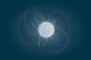
Eruption of mega-magnetic star lights up nearby galaxy
Thanks to ESA satellites, an international team including UNIGE researchers has detected a giant eruption coming from a magnetar, an extremely magnetic neutron star. While ESA’s satellite INTEGRAL was observing…

Solving the riddle of the sphingolipids in coronary artery disease
Weill Cornell Medicine investigators have uncovered a way to unleash in blood vessels the protective effects of a type of fat-related molecule known as a sphingolipid, suggesting a promising new…


