Mapping glaciers
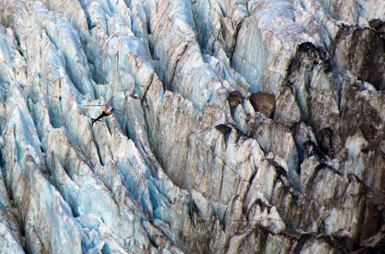
A helicopter takes researcher Mattia Brughelli up to the Franz Josef Glacier in New Zealand. © Benjamin Lehmann
Supported by the Swiss National Science Foundation (SNSF), a team led by Frédéric Herman of the University of Lausanne has mapped the Franz Josef Glacier in New Zealand.
The researchers have developed a new technique to study more precisely the relationships between global warming, glacier movement and erosion of rocks located below the ice mass.
“The glacier is over 10 kilometres in length and fairly similar to those found in Switzerland,” explains Frédéric Herman. “We selected it because of its location on a tectonic fault, with contrasting geological layers that contain graphite, an element that provides us with information on erosion.” The results of the study have been published in Science (*).
Probing the geological history
The researchers used a combination of two techniques to map the glacier. First, stereoscopic satellite imagery allowed them to estimate the speed of movement at the surface. They were then able to extrapolate the speed at which the lower layer is sliding over the bedrock (between 30 and 300 metres each year).
At the same time, the study sought to quantify the intensity of erosion below the glacier – the extent to which the glacier erodes the rock below it as it slides along. The research team took an indirect approach, as Frédéric Herman explains:
“We studied the crystalline structure of the graphite – carbon formed from fossilised organic matter – contained within the rock flour retrieved downstream of the glacier. It provides us with quite precise information on the conditions at the time the graphite was formed, in particular its temperature, which was between 300 and 700 degrees. When we compare this with samples taken from around the glacier, we can work out the origin of the flour. Since the quantity of flour is directly linked to the rate of erosion, it is possible to draw a map showing the intensity of erosion beneath the glacier.”
The researchers used the Raman spectroscopy technique to analyse the crystalline structure of the material. “Until now, geologists relied on isotope analysis, which requires very heavy equipment,” continues the researcher. “It could take years just to obtain forty samples. With our technique, our Master’s student Mattia Brughelli successfully analysed 4000 samples in two weeks, and then produced a very precise map of the glacier with a resolution of 1 metre.”
A theory validated
The measurements confirm a theoretical model that was proposed in 1979, predicting that erosion is not simply proportional to the speed of movement of the glacier, but is related to its square. “In the last few decades, we have been able to observe that glacier movement is accelerating,” says Frédéric Herman.
“Our model indicates that erosion will intensify in a non-linear fashion with global warming.” That means there will be increased sediment levels in alpine streams, which will increase the risk of debris flow, a mix of water and mud. “Our work shows that natural systems can be very perceptible to changes in the environment, even mountains.”
The study was realised in cooperation with the French National Museum of Natural History, the Californian Institute of Technology and the Institute of Geological and Nuclear Survey Science in New Zealand.
(*) F. Herman et al. (2015). Erosion by an Alpine glacier, Science, vol. 350, 6257, doi/10.1126/science.aab2386
- Download Image 1
Geologists from Lausanne have studied the Franz Josef Glacier.
© Benjamin Lehmann - Download Image 2
A helicopter takes researcher Mattia Brughelli up to the Franz Josef Glacier in New Zealand. © Benjamin Lehmann - Download Image 3
University of Lausanne researcher Mattia Brughelli by the side of the Franz Josef Glacier. © Benjamin Lehmann - Download Image 4
The Franz Josef Glacier in New Zealand. © Benjamin Lehmann
Contact
Professor Frédéric Herman
Institute of Earth Surface Dynamics
University of Lausanne
1015 Lausanne
Tel: +41 (0)21 692 43 80 and +41 (0)79 608 32 98
E-mail: Frederic.Herman@unil.ch
http://www.snf.ch/en/researchinFocus/newsroom/Pages/news-151009-press-release-ma…
Media Contact
All latest news from the category: Earth Sciences
Earth Sciences (also referred to as Geosciences), which deals with basic issues surrounding our planet, plays a vital role in the area of energy and raw materials supply.
Earth Sciences comprises subjects such as geology, geography, geological informatics, paleontology, mineralogy, petrography, crystallography, geophysics, geodesy, glaciology, cartography, photogrammetry, meteorology and seismology, early-warning systems, earthquake research and polar research.


Newest articles

Properties of new materials for microchips
… can now be measured well. Reseachers of Delft University of Technology demonstrated measuring performance properties of ultrathin silicon membranes. Making ever smaller and more powerful chips requires new ultrathin…

Floating solar’s potential
… to support sustainable development by addressing climate, water, and energy goals holistically. A new study published this week in Nature Energy raises the potential for floating solar photovoltaics (FPV)…

Skyrmions move at record speeds
… a step towards the computing of the future. An international research team led by scientists from the CNRS1 has discovered that the magnetic nanobubbles2 known as skyrmions can be…

