MARLIT, artificial intelligence against marine litter
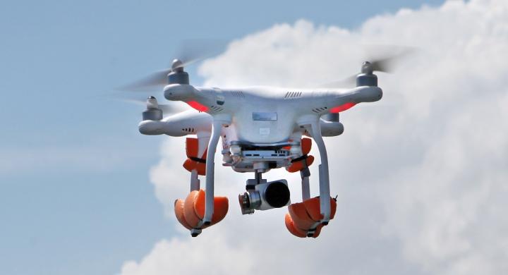
In the future, it is expected to adapt the app to a remote sensor (for instance, a drone) to automate the remote sensing process).
Credit: Àlex Aguilar (UNIVERSITY OF BARCELONA - IRBio)
Litter that floats and pollutes the ocean
Floating sea macro-litter is a threat to the conservation of marine ecosystems worldwide. The largest density of floating litter is in the great ocean gyres -systems of circular currents that spin and catch litter- but the polluting waste is abundant in coastal waters and semi closed seas such as the Mediterranean.
MARLIT, an open access web app based on an algorithm designed with deep learning techniques, will enable the detection and quantification of floating plastics in the sea with a reliability over 80%, according to a study published in the journal Environmental Pollution and carried out by experts of the Faculty of Biology and the Biodiversity Research Institute of the University of Barcelona (IRBio).
This methodology results from the analysis through artificial intelligence techniques of more than 3,800 aerial images of the Mediterranean coast in Catalonia, and it will allow researchers to make progress in the assessment of the presence, density and distribution of the plastic pollutants in the seas and oceans worldwide. Among the participants in the study, published in the journal Environmental Pollution, are the experts of the Consolidated Research Group on Large Marine Vertebrates of the UB and IRBio, and the Research Group on Biostatistics and Bioinformatics (GRBIO) of the UB, integrated in the Bioinformatics Barcelona platform (BIB).
Litter that floats and pollutes the ocean
Historically, direct observations (boats, planes, etc.) are the base for the common methodology to assess the impact of floating marine macro-litter (FMML). However, the great ocean area and the volume of data make it hard for the researchers to advance with the monitoring studies.
“Automatic aerial photography techniques combined with analytical algorithms are more efficient protocols for the control and study of this kind of pollutants”, notes Odei Garcia-Garin, first author of the article and member of the CRG on Large Marine Mammals, led by Professor Àlex Aguilar.
“However, -he continues-, automated remote sensing of these materials is at an early stage. There are several factors in the ocean (waves, wind, clouds, etc.) that harden the detection of floating litter automatically with the aerial images of the marine surface. This is why there are only a few studies that made the effort to work on algorithms to apply to this new research context”.
The experts designed a new algorithm to automate the quantification of floating plastics in the sea through aerial photographs by applying the deep learning techniques, automatic learning methodology with artificial neuronal networks able to learn and take the learning to higher levels.
“The great amount of images of the marine surface obtained by drones and planes in monitoring campaigns on marine litter -also in experimental studies with known floating objects- enabled us to develop and test a new algorithm that reaches a 80% of precision in the remote sensing of floating marine macro-litter”, notes Garcia-Garin, member of the Department of Evolutionary Biology, Ecology and Environmental Sciences of the UB and IRBio.
Preservation of the oceans with deep learning techniques
The new algorithm has been implemented to MARLIT, an open access web app described in the article and which is available to all managers and professionals in the study of the detection and quantification of floating marine macro-litter with aerial images. In particular, this is a proof of concept based on an R Shiny package, a methodological innovation with great interest to speed up the monitoring procedures of floating marine macro-litter.
MARLIT enables the analysis of images individually, as well as to divide them into several segments -according to the user’s guidelines-, identify the presence of floating litter in each certain area and estimate their density with the image metadata (height, resolution). In the future, it is expected to adapt the app to a remote sensor (for instance, a drone) to automate the remote sensing process.
At a European level, the EU Marine Strategy Framework Directive indicates the application of FMML monitoring techniques to fulfil the continuous assessment of the environmental state of the marine environment. “Therefore, the automatization of monitoring processes and the use of apps such as MARLIT would ease the member states’ fulfilment of the directive”, conclude the authors of the study.
All latest news from the category: Ecology, The Environment and Conservation
This complex theme deals primarily with interactions between organisms and the environmental factors that impact them, but to a greater extent between individual inanimate environmental factors.
innovations-report offers informative reports and articles on topics such as climate protection, landscape conservation, ecological systems, wildlife and nature parks and ecosystem efficiency and balance.


Newest articles

Silicon Carbide Innovation Alliance to drive industrial-scale semiconductor work
Known for its ability to withstand extreme environments and high voltages, silicon carbide (SiC) is a semiconducting material made up of silicon and carbon atoms arranged into crystals that is…

New SPECT/CT technique shows impressive biomarker identification
…offers increased access for prostate cancer patients. A novel SPECT/CT acquisition method can accurately detect radiopharmaceutical biodistribution in a convenient manner for prostate cancer patients, opening the door for more…

How 3D printers can give robots a soft touch
Soft skin coverings and touch sensors have emerged as a promising feature for robots that are both safer and more intuitive for human interaction, but they are expensive and difficult…

