Strong quake, small tsunami
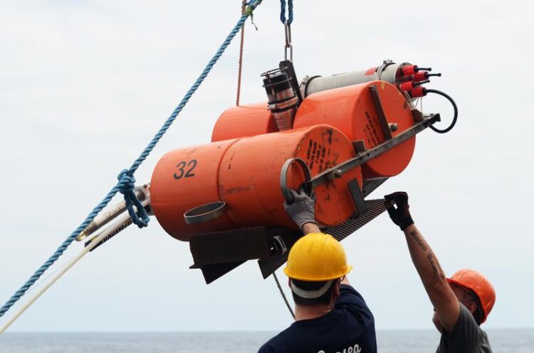
For a total of two years, 15 ocean bottom seismometers off northern Chile recorded aftershocks from the 2014 Iquique earthquake.
Credit: Jan Steffen/GEOMAR
GEOMAR scientists publish unique data set on the northern Chilean subduction zone.
Northern Chile is an ideal natural laboratory to study the origin of earthquakes. Here, the Pacific Nazca plate slides underneath the South American continental plate with a speed of about 65 millimetres per year. This process, known as subduction, creates strain between the two plates and scientists thus expected a mega-earthquake here sooner or later, like the last one in 1877. But although northern Chile is one of the focal points of global earthquake research, until now there was no comprehensive data set on the structure of the marine subsurface – until nature itself stepped in to help.
On 1 April 2014, a segment of the subduction zone finally ruptured northwest of the city of Iquique. The earthquake with a moment magnitude of 8.1 released at least parts of accumulated stresses. Subsequent seismic measurements off the coast of Chile as well as seafloor mapping and land-based data provided a hitherto unique insight into the architecture of the plate boundary. “Among other things, this allows us to explain why a relatively severe quake like the one in 2014 only triggered a relatively weak tsunami,” says Florian Petersen from GEOMAR Helmholtz Centre for Ocean Research Kiel. He is the lead author of the study, which has now been published in the journal Geophysical Research Letters.
As early as December 2014, just eight months after the main earthquake, the Kiel team deployed 15 seismic measuring devices specially developed for the deep sea off the coast of Chile. “The logistical and also administrative challenges for the deployment of these ocean-bottom seismometers are challenging and eight months of preparation time is very short. However, since the investigations are crucial to better comprehend the hazard potential of the plate margin off northern Chile, even the Chilean Navy finally supported us by making its patrol boat COMANDANTE TORO available,” reports project leader and co-author Dr. Dietrich Lange from GEOMAR.
At the end of 2015, these ocean bottom seismometers (OBS) were recovered by the German research vessel SONNE. The team on board serviced the devices, read out the data and placed the OBS on the seabed again. It was not until November 2016 that the American research vessel MARCUS G. LANGSETH finally recovered them. “Together with data from land, we have obtained a seismic data set of the earthquake region over 24 months, in which we can find the signals of numerous aftershocks. This is unique so far,” explains Florian Petersen, for whom the study is part of his doctoral thesis.
The evaluation of the long-term measurements, in which colleagues from the Universidad de Chile and Oregon State University (USA) were also involved, showed that an unexpectedly large number of aftershocks were located between the actual earthquake rupture zone and the deep-sea trench. “But what surprised us even more was that many aftershocks were quite shallow. They occurred in the overlying South American continental plate and not along the plate boundary of the dipping Nazca plate,” Petersen says.
Over many earthquake cycles, these aftershocks can strongly disturb and rupture the seaward edge of the continental plate. Resulting gaps fill with pore fluids. As a result, the authors conclude, the energy of the quakes can only propagate downwards, but not to the deep-sea trench off the coast of Chile. “Therefore, there were no large, sudden shifts of the seafloor during the 2014 earthquake and the tsunami was fortunately relatively small”, says Florian Petersen.
The question still remains whether the Iquique earthquake of 2014 was already the expected major quake in the region or whether it only released some of the stress that had built up since 1877. “The region remains very exciting for us. The current results were only possible due to the close cooperation of several nations and the use of research vessels from Germany, Chile and the USA. This shows the immense effort that is required to study marine natural hazards. However, this is critical for a detailed assessment of the risk to the coastal cities in northern Chile, so everyone was dedicated to the task,” says co-author Prof. Dr. Heidrun Kopp from GEOMAR.
All latest news from the category: Earth Sciences
Earth Sciences (also referred to as Geosciences), which deals with basic issues surrounding our planet, plays a vital role in the area of energy and raw materials supply.
Earth Sciences comprises subjects such as geology, geography, geological informatics, paleontology, mineralogy, petrography, crystallography, geophysics, geodesy, glaciology, cartography, photogrammetry, meteorology and seismology, early-warning systems, earthquake research and polar research.


Newest articles

Silicon Carbide Innovation Alliance to drive industrial-scale semiconductor work
Known for its ability to withstand extreme environments and high voltages, silicon carbide (SiC) is a semiconducting material made up of silicon and carbon atoms arranged into crystals that is…

New SPECT/CT technique shows impressive biomarker identification
…offers increased access for prostate cancer patients. A novel SPECT/CT acquisition method can accurately detect radiopharmaceutical biodistribution in a convenient manner for prostate cancer patients, opening the door for more…

How 3D printers can give robots a soft touch
Soft skin coverings and touch sensors have emerged as a promising feature for robots that are both safer and more intuitive for human interaction, but they are expensive and difficult…

