NASA Sees Tropical Storm Lowell's Tough South Side
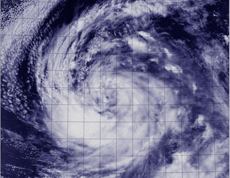
The VIIRS instrument that flies aboard NASA-NOAA's Suomi NPP satellite captured a visible image of Tropical Storm Lowell on August 19 at 5:42 p.m. EDT. Image Credit: NRL/NASA/NOAA
NOAA took its GOES-14 satellite out of storage to simulate how the upcoming GOES-R satellite will work and captured a lot of data on Tropical Storm Lowell on August 19.
Those data were used to create an animation that showed a gradual increase in the organization of a band of thunderstorms during the day.
The Visible Infrared Imaging Radiometer Suite (VIIRS) instrument that flies aboard NASA-NOAA's Suomi NPP satellite captured a visible image of Tropical Storm Lowell on August 19 at 21:42 UTC (5:42 p.m. EDT).
The image showed a thick band of thunderstorms southwest of the center of circulation, wrapping into the center.
At 5 a.m. EDT on Wednesday, August 20, the National Hurricane Center (NHC) noted that curved bands of thunderstorms remained well organized on the south side of the circulation, but strong showers and thunderstorms were lacking to the north of the center.
At the same time, the center of Tropical Storm Lowell was located near latitude 18.7 north and longitude 121.0 west. That's about 775 miles (1,245 km) west-southwest of the southern tip of Baja California. Maximum sustained winds remain near 50 mph (85 kph).
Lowell was moving toward the northwest near 5 mph (7 kph) and the NHC expects a slow northwest to north-northwest motion during the next day or so.
Forecaster Cangialosi at NHC noted that Lowell is currently over 27C/80.6F waters, and in an atmosphere of fairly low shear and high moisture. Tropical cyclones need waters at least near 26.6C/80F to maintain strength. Since the storm is expected to remain in these favorable conditions for another day and a half, some strengthening is forecast.
Text credit: Rob Gutro
NASA's Goddard Space Flight Center
Media Contact
More Information:
http://www.nasa.gov/content/goddard/12e-eastern-pacific-ocean/All latest news from the category: Earth Sciences
Earth Sciences (also referred to as Geosciences), which deals with basic issues surrounding our planet, plays a vital role in the area of energy and raw materials supply.
Earth Sciences comprises subjects such as geology, geography, geological informatics, paleontology, mineralogy, petrography, crystallography, geophysics, geodesy, glaciology, cartography, photogrammetry, meteorology and seismology, early-warning systems, earthquake research and polar research.


Newest articles

Properties of new materials for microchips
… can now be measured well. Reseachers of Delft University of Technology demonstrated measuring performance properties of ultrathin silicon membranes. Making ever smaller and more powerful chips requires new ultrathin…

Floating solar’s potential
… to support sustainable development by addressing climate, water, and energy goals holistically. A new study published this week in Nature Energy raises the potential for floating solar photovoltaics (FPV)…

Skyrmions move at record speeds
… a step towards the computing of the future. An international research team led by scientists from the CNRS1 has discovered that the magnetic nanobubbles2 known as skyrmions can be…

