GOES satellite movie tracked tornadic Texas trouble
NOAA's Geostationary Operational Environmental Satellite, GOES-13, captures visible and infrared images of weather over the eastern U.S. every 15 minutes, and captured the movement of the weather system that generated the Texas twisters.
The 23 second movie runs from April 2 at 1615 UTC through April 4 at 1615 UTC (11:15 a.m. CDT), and shows the progression of the storm system that generated about 15 tornadoes on April 3. Around 2215 UTC (5:15 p.m. CDT) on April 3, the tail end of the front appeared in the GOES animation as a pie-shaped wedge that continued to thin out.
It is that wedge where the tornadoes were generated and touched down in the southeastern Dallas suburbs. One thing people viewing the video can take from the satellite view is that if they're seeing GOES imagery live on television, they can relate wedge shaped-frontal clouds with severe weather and be prepared.
NOAA operates the GOES series of satellites, and NASA's GOES Project, located at NASA's Goddard Space Flight Center in Greenbelt, Md. compiles the images into animations. The GOES visible and infrared data is compiled and then overlayed on a true-color land surface map of the U.S. that was created using data from the Moderate Resolution Imaging Spectroradiometer instrument that flies on NASA's Aqua and Terra satellites.
At least 15 tornadoes were reported in Texas yesterday afternoon, south and southeast of the Dallas metro area. According to the National Weather Service, reports of tornadoes were from: 4 miles south of Cumby; 3 to 5 miles south of Royse City; 5 miles south of Sulphur Springs and in the town, Campbell, 10 miles west of Quinlan, 4 miles southeast of Pickton, 4 miles north of Lone Oak, Lancaster, Forney, Cleburne, Everman, Oak Leaf, and Mesquite. The National Weather Service's Fort Worth office noted that most of the tornadoes were between EF2 and EF1 on the Fujita scale. According to WFAA-TV meteorologist Steve McCauley, preliminary analysis showed that EF-2 tornadoes (with max. winds of 130 mph) struck Arlington and Lancaster, and an EF-3 (150 mph winds) hit Forney. A National Weather Service website was created to provide reports of hail, wind and tornado reports at: https://nwschat.weather.gov/lsr/#FWD/201204030500/201204040440/0100.
Live video shot on April 3 on the south side of Dallas aired on the Weather Channel that showed semi-tractor trailer truck s being lifted about 50 feet in the air from the tornado. Local Dallas-area television station WFAA-TV provided a severe weather blog that covers many incidents related to the storms. It can be found here: http://www.wfaa.com/news/weather/Severe-weather-blog-Tornado-warnings-issued-145963545.html
Anyone who experiences severe storms on the ground would likely want to see how they appear to develop in satellite view, as it may provide extra warning time. GOES satellites continue to provide continuous coverage over the entire U.S., as the clean up continues today in Texas.
You can view a related video here:
http://www.nasa.gov/multimedia/videogallery/index.html?collection_id=13587&media_id=139023361
Media Contact
More Information:
http://www.nasa.govAll latest news from the category: Information Technology
Here you can find a summary of innovations in the fields of information and data processing and up-to-date developments on IT equipment and hardware.
This area covers topics such as IT services, IT architectures, IT management and telecommunications.


Newest articles
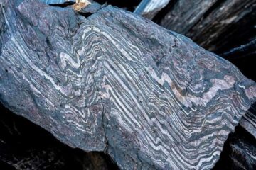
Rocks with the oldest evidence yet of Earth’s magnetic field
The 3.7 billion-year-old rocks may extend the magnetic field’s age by 200 million years. Geologists at MIT and Oxford University have uncovered ancient rocks in Greenland that bear the oldest…
Decisive breakthrough for battery production
Storing and utilising energy with innovative sulphur-based cathodes. HU research team develops foundations for sustainable battery technology Electric vehicles and portable electronic devices such as laptops and mobile phones are…

Superradiant atoms could push the boundaries of how precisely time can be measured
Superradiant atoms can help us measure time more precisely than ever. In a new study, researchers from the University of Copenhagen present a new method for measuring the time interval,…

