Two NASA Satellites Get Data on Category 5 Super Typhoon Vongfong
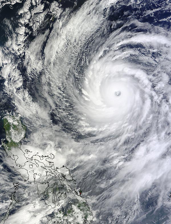
On Oct. 8 at 02:15 UTC (Oct. 7 at 10:15 p.m. EDT), NASA's Terra satellite captured this view of the wide circular eye in Super Typhoon Vongfong in the Philippine Sea. Image Credit: NASA Goddard MODIS Rapid Response Team
Typhoon Vongfong formed on October 2, 2014 southeast of Guam. Typhoon Phanfone, that recently pummeled Japan, formed near the same area in the western Pacific Ocean.
Vongfong had wind speeds of about 120 knots (138 mph) when the Tropical Rainfall Measuring Mission or TRMM satellite flew above the intensifying typhoon's eye on October 7, 2014 at 0800 UTC (4 a.m. EDT).
TRMM's Precipitation Radar (PR) showed that powerful storms in Vongfong's eye wall were producing very heavy rainfall. TRMM's Microwave Imager (TMI) show that multiple rain bands spiraling into Vongfong were also dropping rain over a large area.
On Oct. 8 at 02:15 UTC (Oct. 7 at 10:15 p.m. EDT), the MODIS instrument aboard NASA's Terra satellite captured a visible image of Super Typhoon Vongfong's wide cloud extend and the storm's wide circular eye.
On Oct. 8 at 1500 UTC (11 a.m. EDT), Vongfong had maximum sustained winds near 145 knots (167 mph/268.5 kph) making it a Category 5 Super Typhoon on the Saffir-Simpson Scale. It was centered near 18.7 north and 130.7 east.
It was centered about 510 nautical miles (586 miles/944.5 kph) south-southeast of Kadena Air Base, Okinawa, Japan. Vongfong was moving to the north at 7 knots (8 mph/13 kph). It was creating extremely rough seas in the Philippine Sea, with wave heights to 50 feet (15.2 meters).
According to the U.S. Kadena Airbase, on Oct. 8, a combined Japanese-U.S. Air Force rescue team recovered the body of the third Airman who had been swept out to sea on Oct. 5 from Typhoon Phanfone.
The Joint Typhoon Warning Center predicts that Vongfong is predicted to weaken slightly while moving toward the islands of southern Japan.
Rob Gutro/Hal Pierce
NASA's Goddard Space Flight Center
Media Contact
All latest news from the category: Earth Sciences
Earth Sciences (also referred to as Geosciences), which deals with basic issues surrounding our planet, plays a vital role in the area of energy and raw materials supply.
Earth Sciences comprises subjects such as geology, geography, geological informatics, paleontology, mineralogy, petrography, crystallography, geophysics, geodesy, glaciology, cartography, photogrammetry, meteorology and seismology, early-warning systems, earthquake research and polar research.


Newest articles

Properties of new materials for microchips
… can now be measured well. Reseachers of Delft University of Technology demonstrated measuring performance properties of ultrathin silicon membranes. Making ever smaller and more powerful chips requires new ultrathin…

Floating solar’s potential
… to support sustainable development by addressing climate, water, and energy goals holistically. A new study published this week in Nature Energy raises the potential for floating solar photovoltaics (FPV)…

Skyrmions move at record speeds
… a step towards the computing of the future. An international research team led by scientists from the CNRS1 has discovered that the magnetic nanobubbles2 known as skyrmions can be…

