South Pole re-routed

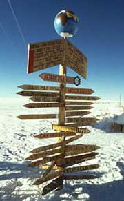
Snow knowing: the south pole is a navigation nightmare. <br>© SPL <br>
Satellites see through snow to steer safely across Antarctica.
Satellite images that expose perilous crevasses now reveal safe overland routes to the South Pole. Carolyn Merry of Ohio State University in Columbus has pieced together high-resolution satellite pictures that see through the snow, to map the passable Pole1.
Since a snow tractor, floundered into a hidden fissure in 1991, all supplies have been flown into the US South Pole research station. Safe transport routes might be a cheaper way to bring in bulk provisions or building materials for the new polar station currently being built.
“It would be a very good tool,” says Cecilie Rolstad of the British Antarctic Survey in Cambridge, UK. In future, polar explorers might study satellite maps before setting out, she predicts. Yawning abysses the length of a football pitch “are a real danger”, says Rolstad.
Merry used infrared images from the Landsat satellite, to pick out light and dark features on snow and ice, plus a visible light image from the SPOT satellite. She mapped routes starting at the McMurdo station, the main port into Antarctica, across the vast Ross Ice Shelf.
Like isobars on a weather map, sweeping lines and rifts on Merry’s map reveal the direction and rates that the ice is flowing and shearing. “It shows areas you should avoid,” she says.
Snow fall
“The surface was white snow for miles around; we could see no relief,” recalls tractor driver Quinton Rhoton: “Then gravity struck.”
In 1991, Rhoton and his companion were driving a snow tractor out from McMurdo dragging a sled full of explosives too dangerous to ship by air. They plummeted into a hidden crevasse. “Shattered glass from the cab window and snow streamed into the cab,” remembers Rhoton. Wedged by a V-shaped gash in the ice, 16 tonnes of cargo were left teetering on the icy lip above them.
Without handholds on the sheer walls, the two waited in the tractor for several hours before other group members hauled them out with ropes.
The crevasse was hidden under an ice bridge – undetectable to the eye – but visible in Cherry’s satellite images. The map suggests that the crevasse formed upstream of the crash site, as stresses on the ice appear insufficient at that spot. “I would have told them not to go there,” says Merry.
References
- Whillans, I.M. & Merry, C.J. Analysis of a shear zine where a tractor fell into a crevasse, western side of the Ross Ice Shelf, Antarctica. Cold Regions Science and Technology, 33, 1 – 17, (2002).
Media Contact
More Information:
http://www.nature.com/nsu/020225/020225-1.htmlAll latest news from the category: Earth Sciences
Earth Sciences (also referred to as Geosciences), which deals with basic issues surrounding our planet, plays a vital role in the area of energy and raw materials supply.
Earth Sciences comprises subjects such as geology, geography, geological informatics, paleontology, mineralogy, petrography, crystallography, geophysics, geodesy, glaciology, cartography, photogrammetry, meteorology and seismology, early-warning systems, earthquake research and polar research.
Newest articles

Combatting disruptive ‘noise’ in quantum communication
In a significant milestone for quantum communication technology, an experiment has demonstrated how networks can be leveraged to combat disruptive ‘noise’ in quantum communications. The international effort led by researchers…

Stretchable quantum dot display
Intrinsically stretchable quantum dot-based light-emitting diodes achieved record-breaking performance. A team of South Korean scientists led by Professor KIM Dae-Hyeong of the Center for Nanoparticle Research within the Institute for…

Internet can achieve quantum speed with light saved as sound
Researchers at the University of Copenhagen’s Niels Bohr Institute have developed a new way to create quantum memory: A small drum can store data sent with light in its sonic…


