Satellite view highlights Europe’s changing landscape
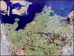
A new tool based on satellite data shows trends in the way Europeans use our landscape. Seen from the ground these changes appear gradual, but viewed from above they are often dramatic.
Each day new roads or buildings bury the equivalent of 240 football fields of German soil, around 120 hectares of land. This is just one example of the information available from a new virtual atlas of Europe’s landscape based on satellite data.
The European Environment Agency (EEA), assisted by ESA’s Earth Observation Directorate, is publishing the data on 17 November.
“What we are able to see from satellite data is that the increase in soil that is sealed off by human infrastructure activities is even greater than we anticipated”, says Chris Steenmans, Project Manager for Land and Remote Sensing at the EEA. “Fragmentation of land is a time bomb. Each year only a small fraction of the landscape will change its function. This is not enough for you to really feel the change as dramatic. But if you use satellite data over a span of ten years you can really see a difference”.
The project is contributing to shaping Europe’s Global Monitoring for Environment and Security (GMES) initiative, which will provide environmental information from a combination of ground-, air- and space-based observation systems. Both EEA and ESA are partners in GMES.
The EEA performed its first survey of Europe using data from the early 1990s. With this new Image2000 survey based on data from 2000 one is able to compare and draw conclusions on trends in the landscape. Technological improvements during the decade also allow much more detailed studies.
“In many areas the data will prove that current policies are insufficient. We hope the tool will assist policy makers to make decisions in a more timely way, along integrated land planning concerns”, comments Ronan Uhel, head of Spatial Analysis at the EEA.
Fragmenting landscape
As an example of an area in need of better policies, Steenmans points to the impact of new motorways on the landscape: “Every day another 10 hectares – the equivalent of 20 football fields – of motorway is constructed in Europe. If you look at this development over a 50-year span you will see dramatic consequences for example for wildlife.
“One has to take into account that once this fragmentation of the landscape has happened, the situation is practically irreversible. Some countries – like Denmark – have tried to re-establish fragmented wetlands but this is very expensive”.
Both the 1990 and the new survey are a part of an EEA programme called Corine (Coordination of Information on the Environment). ESA has assisted in the development of services based on satellite data.
“From ESA’s side we view this as a process which is more pulled by the users than pushed by technology. There is almost no end to the possibilities within the technology, so we focus on first developing services in the fields with the greatest demand”, says Oliver Arino of ESA’s Earth Observation Directorate.
He explains that, in the case of monitoring changes in the landscape one can choose practically any scale depending on whether the focus is local, county, national or regional: “Depending on what kind of detail the user wants, we will have to use data from a different kind of satellite. But the processing of the data will be almost the same”.
“Will my house be flooded?”
Professor Jacqueline McGlade, Executive Director of the EEA, believes remote sensing from space opens plenty of new ground. She takes flooding as an example: “Based on satellite observations of actual floodings in recent years we will be able to see some trends. We can point out which areas are at higher risk of future flooding, and we can analyse how roads and other forms of sealing of the soil will impact flooding.
“This information is obviously of interest to policy makers. At the same time information on flooding will attract attention from people living in these areas. They might not be so interested in the overall trends but they want to know ’Will my house be flooded?’ Similarly people might want to check a number of other environmental developments in their neighbourhood.”
The first edition of the virtual atlas based on 1990 data attracted more than 10 000 users. A dramatic increase in the number of users can be expected with the new version, as users will have much more detail and also be able to compare the changes over a decade.
Media Contact
More Information:
http://www.esa.intAll latest news from the category: Earth Sciences
Earth Sciences (also referred to as Geosciences), which deals with basic issues surrounding our planet, plays a vital role in the area of energy and raw materials supply.
Earth Sciences comprises subjects such as geology, geography, geological informatics, paleontology, mineralogy, petrography, crystallography, geophysics, geodesy, glaciology, cartography, photogrammetry, meteorology and seismology, early-warning systems, earthquake research and polar research.


Newest articles

Bringing bio-inspired robots to life
Nebraska researcher Eric Markvicka gets NSF CAREER Award to pursue manufacture of novel materials for soft robotics and stretchable electronics. Engineers are increasingly eager to develop robots that mimic the…

Bella moths use poison to attract mates
Scientists are closer to finding out how. Pyrrolizidine alkaloids are as bitter and toxic as they are hard to pronounce. They’re produced by several different types of plants and are…

AI tool creates ‘synthetic’ images of cells
…for enhanced microscopy analysis. Observing individual cells through microscopes can reveal a range of important cell biological phenomena that frequently play a role in human diseases, but the process of…

