NASA Scientists Watching, Studying Arctic Changes This Summer
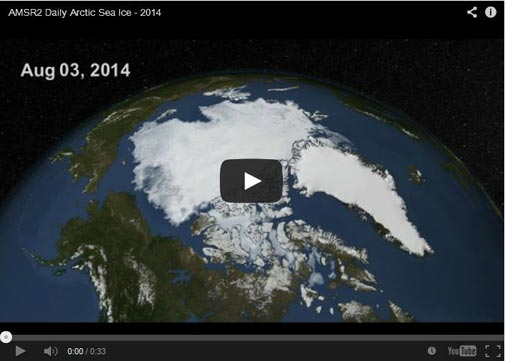
This visualization of the Arctic sea ice cap’s seasonal melting is based on satellite data from the AMSR2 instrument operated by the Japan Aerospace Exploration Agency (JAXA). Image Credit: Cindy Starr, NASA Goddard's Scientific Visualization Studio
As of Aug. 19, Arctic sea ice covered about 2.31 million square miles. While this is on track to be larger than the record-breaking low year in 2012, the sea ice extent is still well below average for the past 30 years, and continues a trend of sea ice loss in the Arctic. From 1981 to 2010, the average sea ice extent on Aug. 19 was 2.72 million square miles – 18 percent larger than on that same date this year.
“While this year is not heading toward a record low minimum extent in the Arctic, sea ice is well below normal and continues an overall pattern of decreasing sea ice during summer in the Arctic,” said sea ice scientist Walt Meier, based at NASA’s Goddard Space Flight Center in Greenbelt, Maryland.
While NASA scientists have used satellites to document sea ice changes for more than 40 years, this summer the agency is also flying three airborne research campaigns to observe different aspects of climate-driven change in the Arctic.
The ARISE (Arctic Radiation-IceBridge Sea and Ice Experiment) campaign will begin flights later this week from Greenland to measure how changing land and sea ice conditions in the region are affecting the formation of clouds and the exchange of heat from Earth’s surface to space.
For some time scientists at NASA and elsewhere have been concerned about how the retreat of sea ice in summer could affect the climate of the Arctic. This campaign is one of the first to study the interaction between sea ice loss and the Arctic atmosphere.
The CARVE (Carbon in Arctic Reservoirs Vulnerability Experiment) campaign is making its third year of flights from Fairbanks, Alaska, over vast regions of Alaska to measure the emissions of greenhouse gases being released from thawing tundra and permafrost.
And an offshoot of NASA’s long-running Operation IceBridge, a plane will fly over Alaskan glaciers to measure how much the thickness of those glaciers has changed from previous years.
For news on these campaigns and the status of Arctic sea ice as it progresses toward its annual minimum, watch for updates on www.nasa.gov/earth and www.nasa.gov/earthrightnow throughout August and September.
Related links:
› ARISE: NASA to Investigate Climate Impacts of Arctic Sea Ice Loss
› CARVE: Is a Sleeping Climate Giant Stirring in the Arctic?
Patrick Lynch
NASA’s Earth Science News Team
Media Contact
All latest news from the category: Earth Sciences
Earth Sciences (also referred to as Geosciences), which deals with basic issues surrounding our planet, plays a vital role in the area of energy and raw materials supply.
Earth Sciences comprises subjects such as geology, geography, geological informatics, paleontology, mineralogy, petrography, crystallography, geophysics, geodesy, glaciology, cartography, photogrammetry, meteorology and seismology, early-warning systems, earthquake research and polar research.


Newest articles

Combatting disruptive ‘noise’ in quantum communication
In a significant milestone for quantum communication technology, an experiment has demonstrated how networks can be leveraged to combat disruptive ‘noise’ in quantum communications. The international effort led by researchers…

Stretchable quantum dot display
Intrinsically stretchable quantum dot-based light-emitting diodes achieved record-breaking performance. A team of South Korean scientists led by Professor KIM Dae-Hyeong of the Center for Nanoparticle Research within the Institute for…

Internet can achieve quantum speed with light saved as sound
Researchers at the University of Copenhagen’s Niels Bohr Institute have developed a new way to create quantum memory: A small drum can store data sent with light in its sonic…

