NASA, CU-Boulder airborne expedition chases Arctic sea ice questions
NASA's Characterization of Arctic Sea Ice Experiment, known as CASIE, began a series of unmanned aircraft system flights in coordination with satellites. Working with CU-Boulder and its research partners, NASA is using the remotely piloted aircraft to image thick, old slabs of ice as they drift from the Arctic Ocean south through the Fram Strait — which lies between Greenland and Svalbard, Norway — and into the North Atlantic Ocean.
NASA's Science Instrumentation Evaluation Remote Research Aircraft, or SIERRA, will weave a pattern over open ocean and sea ice to map and measure ice conditions below cloud cover to as low as 300 feet.
“Our project is attempting to answer some of the most basic questions regarding the most fundamental changes in sea-ice cover in recent years,” said CU-Boulder Research Professor James Maslanik of the aerospace engineering sciences department and principal investigator for the NASA mission. “Our analysis of satellite data shows that in 2009 the amount of older ice is just 12 percent of what it was in 1988 — a decline of 74 percent. The oldest ice types now cover only 2 percent of the Arctic Ocean as compared to 20 percent in the 1980s.”
SIERRA, laden with scientific instruments, travels long distances at low altitudes, flying below the clouds. The aircraft has high maneuverability and slow flight speed. SIERRA's relatively large payload, approximately 100 pounds, combined with a significant range of 500 miles and a small, 20-foot wingspan makes it the ideal aircraft for the expedition.
The mission is conducted from the Ny-Alesund research base on the island of Svalbard, Norway, located near the northeastern tip of Greenland. Mission planners are using satellite data to direct flights of the aircraft.
“We demonstrated the utility of small- to medium-class unmanned aircraft systems for gathering science data in remote, harsh environments during the CASIE mission,” said Matt Fladeland, CASIE project and SIERRA manager at NASA's Ames Research Center in Moffett Field, Calif.
The aircraft observations will be complemented by NASA satellite large-scale views of many different features of the Arctic ice. The Moderate Resolution Imaging Spectroradiometer aboard NASA's Aqua satellite will be used to identify the ice edge location, ice features of interest and cloud cover. Other sensors such as the Advanced Microwave Scanning Radiometer-Earth Observing System on Aqua and the Quick Scatterometer satellite can penetrate cloud cover and analyze the physical properties of ice.
By using multiple types of satellite data, in conjunction with high-resolution aircraft products, more can be learned about ice conditions than is possible by using one or two data analysis methods.
NASA's CASIE mission supports a larger NASA-funded research effort titled “Sea Ice Roughness as an Indicator of Fundamental Changes in the Arctic Ice Cover: Observations, Monitoring, and Relationships to Environmental Factors.” The project also supports the goals of the International Polar Year, a major international scientific research effort involving many NASA research efforts to study large-scale environmental changes in Earth's polar regions.
Other CU-Boulder participants in CASIE include Research Associate Ute Herzfeld, aerospace engineering graduate student Ian Crocker and Professional Research Assistant Katja Wegrzyn.
The CASIE expedition is providing mission updates online at:
http://blogs.nasa.gov/cm/blog/CASIE
For more information about CASIE visit http://www.espo.nasa.gov/casie/.
Media Contact
More Information:
http://www.colorado.eduAll latest news from the category: Earth Sciences
Earth Sciences (also referred to as Geosciences), which deals with basic issues surrounding our planet, plays a vital role in the area of energy and raw materials supply.
Earth Sciences comprises subjects such as geology, geography, geological informatics, paleontology, mineralogy, petrography, crystallography, geophysics, geodesy, glaciology, cartography, photogrammetry, meteorology and seismology, early-warning systems, earthquake research and polar research.


Newest articles

Solving the riddle of the sphingolipids in coronary artery disease
Weill Cornell Medicine investigators have uncovered a way to unleash in blood vessels the protective effects of a type of fat-related molecule known as a sphingolipid, suggesting a promising new…
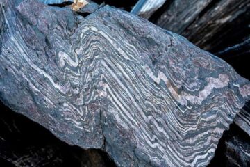
Rocks with the oldest evidence yet of Earth’s magnetic field
The 3.7 billion-year-old rocks may extend the magnetic field’s age by 200 million years. Geologists at MIT and Oxford University have uncovered ancient rocks in Greenland that bear the oldest…
Mini-colons revolutionize colorectal cancer research
As our battle against cancer rages on, the quest for more sophisticated and realistic models to study tumor development has never been more critical. Until now, research has relied on…

