Melting of the Greenland ice sheet mapped
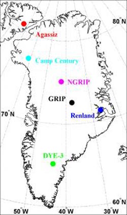
This is a map of the ice core drilling locations discussed in the article. Credit: Center for Ice and Climate, Niels Bohr Institute, University of Copenhagen
The key concern is how stable the ice cap actually is and new Danish research from the Niels Bohr Institute at the University of Copenhagen can now show the evolution of the ice sheet 11,700 years back in time – all the way back to the start of our current warm period. The results are published in the esteemed journal Nature.
Numerous drillings have been made through both Greenland's ice sheet and small ice caps near the coast. By analysing every single annual layer in the kilometres long ice cores researchers can get detailed information about the climate of the past. But now the Danish researcher Bo Vinther and colleagues from the Centre for Ice and Climate at the Niels Bohr Institute, University of Copenhagen, in collaboration with researchers from Canada, France and Russia, have found an entirely new way of interpreting the information from the ice core drillings.
“Ice cores from different drillings show different climate histories. This could be because they were drilled at very different places on and near Greenland, but it could also be due to changes in the elevation of the ice sheet, because the elevation itself causes different temperatures” explains Bo Vinther about the theory.
Today the ice sheet is more than three kilometres thick at its highest point and thinning out towards the coast. Four of the drillings analysed are from the central ice sheet, while two of the drillings are from small ice caps outside of the ice sheet itself, at Renland on the east coast and Agassiz which lies just off of the northwest coast of Greenland in Canada.
Small ice caps show the standard
The small ice caps are stable and have not changed in elevation, and even though they lie very far apart from each other on either side of the central ice sheet, they show the same climate history. This means that one can use the small ice caps climate history as a standard reference for the others.
Bo Vinther explains, that the four drillings through the ice sheet would have had the same climate history if there had not been changes in elevation throughout the course of time. It is known that for every 100 meter increase in elevation, there is a 0.6 per mille decrease in the level of the oxygen isotope Oxygen-18, which indicates the temperature in the air. So if there is a difference of 1.2 per mille, the elevation has changed by 200 meters.
By comparing the Oxygen-18 content in all of the annual layers from the four drillings through the ice sheet with the Oxygen-18 content of the same annual layers in the small ice caps, Bo Vinther has calculated the elevation course through 11,700 years.
Temperature sensitive ice sheet
Just after the ice age the elevation of the ice sheet rose slightly. This is because when the climate transitions from ice age to warm age, there is a rapid increase in precipitation. But at the same time, the areas lying near the coast begin to decrease in size, because the ice is melting at the edge. When the ice melts at the edge, it slowly causes the entire ice sheet to 'collapse' and become lower.
The calculations show that in the course of about 3,000 years the elevation changed and became up to 600 meters lower in the coastal areas. But in the middle it was a slow process, where the elevation decreased around 150 meters in the course of around 6,000 years. It then stabilised.
The elevations that were found with the help of the Oxygen-18 measurements from the ice cores are checked with other methods, for example, by measuring the air content, which is also dependent upon the elevation.
The new results show the evolution of elevation of the ice sheet throughout 11,700 years and they show that the ice sheet is very sensitive to the temperature. The results can be used to make new calculations for models predicting future consequences of climate changes.
Contact: Bo Møllesøe Vinther, ph.d. Center for Ice and Climate, Niels Bohr Institute, University of Copenhagen, +45 3532-0518, mob: +45 2064-4144 bo@gfy.ku.dk
Jørgen Peder Steffensen, ph.d. Center for Ice and Climate, Niels Bohr Institute, University of Copenhagen, +45 3532-0557, jps@gfy.ku.dk
Media Contact
More Information:
http://www.ku.dkAll latest news from the category: Earth Sciences
Earth Sciences (also referred to as Geosciences), which deals with basic issues surrounding our planet, plays a vital role in the area of energy and raw materials supply.
Earth Sciences comprises subjects such as geology, geography, geological informatics, paleontology, mineralogy, petrography, crystallography, geophysics, geodesy, glaciology, cartography, photogrammetry, meteorology and seismology, early-warning systems, earthquake research and polar research.


Newest articles

Silicon Carbide Innovation Alliance to drive industrial-scale semiconductor work
Known for its ability to withstand extreme environments and high voltages, silicon carbide (SiC) is a semiconducting material made up of silicon and carbon atoms arranged into crystals that is…

New SPECT/CT technique shows impressive biomarker identification
…offers increased access for prostate cancer patients. A novel SPECT/CT acquisition method can accurately detect radiopharmaceutical biodistribution in a convenient manner for prostate cancer patients, opening the door for more…

How 3D printers can give robots a soft touch
Soft skin coverings and touch sensors have emerged as a promising feature for robots that are both safer and more intuitive for human interaction, but they are expensive and difficult…

