GPS solution provides three-minute tsunami alerts
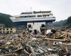
Boat dragged inland in Akahama, Japan by the 2011 tsunami. Stephen Vaughan <br>
For the devastating Japan 2011 event, the team reveals that the analysis of the GPS data and issue of a detailed tsunami alert would have taken no more than three minutes. The results are published on 17 May in Natural Hazards and Earth System Sciences, an open access journal of the European Geosciences Union (EGU).
Most tsunamis, including those in offshore Sumatra, Indonesia in 2004 and Japan in 2011, occur following underwater ground motion in subduction zones, locations where a tectonic plate slips under another causing a large earthquake. To a lesser extent, the resulting uplift of the sea floor also affects coastal regions. There, researchers can measure the small ground deformation along the coast with GPS and use this to determine tsunami information.
“High-precision real-time processing and inversion of these data enable reconstruction of the earthquake source, described as slip at the subduction interface. This can be used to calculate the uplift of the sea floor, which in turn is used as initial condition for a tsunami model to predict arrival times and maximum wave heights at the coast,” says lead-author Andreas Hoechner from the German Research Centre for Geosciences (GFZ).
In the new Natural Hazards and Earth System Sciences paper, the researchers use the Japan 2011 tsunami, which hit the country’s northeast coast in less than half an hour and caused significant damage, as a case study. They show that their method could have provided detailed tsunami alert as soon as three minutes after the beginning of the earthquake that generated it.
“Japan has a very dense network of GPS stations, but these were not being used for tsunami early warning as of 2011. Certainly this is going to change soon,” states Hoechner.
The scientists used raw data from the Japanese GPS Earth Observation Network (GEONET) recorded a day before to a day after the 2011 earthquake. To shorten the time needed to provide a tsunami alert, they only used data from 50 GPS stations on the northeast coast of Japan, out of about 1200 GEONET stations available in the country.
At present, tsunami warning is based on seismological methods. However, within the time limit of 5 to 10 minutes, these traditional techniques tend to underestimate the earthquake magnitude of large events. Furthermore, they provide only limited information on the geometry of the tsunami source (see note). Both factors can lead to underprediction of wave heights and tsunami coastal impact. Hoechner and his team say their method does not suffer from the same problems and can provide fast, detailed and accurate tsunami alerts.
The next step is to see how the GPS solution works in practice in Japan or other areas prone to devastating tsunamis. As part of the GFZ-lead German Indonesian Tsunami Early Warning System project, several GPS stations were installed in Indonesia after the 2004 earthquake and tsunami near Sumatra, and are already providing valuable information for the warning system.
“The station density is not yet high enough for an independent tsunami early warning in Indonesia, since it is a requirement for this method that the stations be placed densely close to the area of possible earthquake sources, but more stations are being added,” says Hoechner.
Note
Traditional tsunami early warning methods use hypocentre (the point directly beneath the epicentre where the seismic fault begins to rupture) and magnitude only, meaning the source of the earthquake and tsunami is regarded as a point source. However, especially in the case of subduction earthquakes, it can have a large extension: in Japan in 2011 the connection between the tectonic plates broke on a length of about 400km and the Sumatra event in 2004 had a length of some 1500km. To get a good tsunami prediction, it is important to consider this extension and the spatial slip distribution.
More information
This research is presented in the paper ‘Instant tsunami early warning based on real time GPS – Tohoku 2011 case study’ to appear in the EGU open access journal Natural Hazards and Earth System Sciences on 17 May 2013 at 14:00 CEST. Please mention the publication if reporting on this story and, if reporting online, include a link to the paper or to the journal website (http://www.nat-hazards-earth-syst-sci.net/).
The scientific article will be available online, free of charge, from the publication date onwards, at http://www.nat-hazards-earth-syst-sci.net/recent_papers.html. To obtain a copy of the paper before the publication date, please email Bárbara Ferreira at media@egu.eu.
The team is composed of A. Hoechner, M. Ge, A.Y. Babeyko and S.V. Sobolev of the GFZ German Research Centre for Geosciences in Potsdam, Germany.
The researchers presented the preliminary results of their study last year at the EGU General Assembly in Vienna, Austria, but only now has the research been peer-reviewed and published in EGU’s Natural Hazards and Earth System Sciences.
The European Geosciences Union (EGU) is Europe’s premier geosciences union, dedicated to the pursuit of excellence in the Earth, planetary, and space sciences for the benefit of humanity, worldwide. It is a non-profit interdisciplinary learned association of scientists founded in 2002. The EGU has a current portfolio of 15 diverse scientific journals, which use an innovative open access format, and organises a number of topical meetings, and education and outreach activities. Its annual General Assembly is the largest and most prominent European geosciences event, attracting over 11,000 scientists from all over the world. The meeting’s sessions cover a wide range of topics, including volcanology, planetary exploration, the Earth’s internal structure and atmosphere, climate, energy, and resources. The 2014 EGU General Assembly is taking place is Vienna, Austria from 27 April to 2 May 2014. For information regarding the press centre at the meeting and media registration, please check http://media.egu.eu closer to the time of the conference.
If you wish to receive our press releases via email, please use the Press Release Subscription Form at http://www.egu.eu/news/subscribe/. Subscribed journalists and other members of the media receive EGU press releases under embargo (if applicable) 24 hours in advance of public dissemination.
Contact
Andreas Hoechner
GFZ German Research Centre for Geosciences
Potsdam, Germany
Tel: +49-331-288-1927
Email: hoechner@gfz-potsdam.de
Bárbara Ferreira
EGU Media and Communications Manager
Munich, Germany
Tel: +49-89-2180-6703
Email: media@egu.eu
Media Contact
All latest news from the category: Earth Sciences
Earth Sciences (also referred to as Geosciences), which deals with basic issues surrounding our planet, plays a vital role in the area of energy and raw materials supply.
Earth Sciences comprises subjects such as geology, geography, geological informatics, paleontology, mineralogy, petrography, crystallography, geophysics, geodesy, glaciology, cartography, photogrammetry, meteorology and seismology, early-warning systems, earthquake research and polar research.


Newest articles

Zap Energy achieves 37-million-degree temperatures in a compact device
New publication reports record electron temperatures for a small-scale, sheared-flow-stabilized Z-pinch fusion device. In the nine decades since humans first produced fusion reactions, only a few fusion technologies have demonstrated…

Innovative microscopy demystifies metabolism of Alzheimer’s
Researchers at UC San Diego have deployed state-of-the art imaging techniques to discover the metabolism driving Alzheimer’s disease; results suggest new treatment strategies. Alzheimer’s disease causes significant problems with memory,…

A cause of immunodeficiency identified
After stroke and heart attack: Every year, between 250,000 and 300,000 people in Germany suffer from a stroke or heart attack. These patients suffer immune disturbances and are very frequently…

