New aircraft for research – Polar 6 ready for first assignment in Antarctica
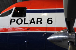
Close-up of Polar 6 in Bremerhaven.<br>Photo: M. Thomsen, Alfred Wegener Institute<br>
The measurement flights will contribute to answering one of the major open questions in climate research: To what degree is the sea level rising due to changes in the ice cover in Antarctica? “The polar regions play a key role in the worldwide development of the climate. Research there thus has high priority for us. We provide modern and reliable research equipment that scientists need for their important work,” states Prof. Dr. Annette Schavan, German Federal Minister of Education and Research. The ministry is funding the purchase and equipping of the Polar 6 with a total of 9.78 million euros.
“Aircraft of the Basler BT-67 type have proven to be outstanding for assignments in the polar regions,” says Prof. Dr. Heinrich Miller, deputy director of the Alfred Wegener Institute for Polar and Marine Research in the Helmholtz Association, who has frequently travelled in the Antarctic on polar aircraft. “We are extremely delighted that with the Polar 6 we now have a second aircraft of this type at our disposal, giving us greater capacity to handle the enormous demand for research flights in polar regions.” It is now possible, he adds, to carry out important investigations in the Arctic in spring without having to shorten the Antarctic season at the same time.
The sister plane Polar 5 has been in operation for the Alfred Wegener Institute since 2007 and has supplied a large volume of valuable data since then. For instance, researchers have developed a system for towing an electromagnetic sensor (EM bird) below the aircraft to measure the thickness of sea ice. Before this was only possible with helicopters and use of the plane will also increase the range several times over. In this way scientists can determine the thickness of sea ice in regions that could not be reached in the past. These data are entered in coupled climate models and thus improve our understanding of the interactions between ocean, ice and atmosphere.
Among others, geophysicists of the Alfred Wegener Institute employ polar aircraft in the Antarctic to determine the structure of the ice and the Earth’s crust below it. This has enabled them to discover previously unknown lakes under ice that reaches a thickness of several kilometres in some cases. Of particular interest to the researchers, however, is how the ice formed, relocated and moved in the course of the Earth’s history. For this purpose deep ice cores will be obtained at selected sites, thus permitting conclusions to be drawn about climate history in the course of the alternation between ice ages and interglacials. The best places for taking such cores will be specified beforehand, e.g. on the basis of aircraft measurements. And to make the picture even more complete, the ice structures between the specific drilling sites will be determined by means of geoscientific measurement flights.
The new research aircraft Polar 6 was modified and approved for operation in polar regions in the USA and Canada. Now technicians and scientists of the Alfred Wegener Institute are equipping the plane with modern measuring instruments in Bremerhaven jointly with technicians and pilots of the operator Kenn Borek Air Ltd. (Calgary, Canada), FIELAX (Bremerhaven), OPTIMARE (Bremerhaven), Werum (Lüneburg) and S. E. A. Datentechnik GmbH (Cologne). Openings in the roof and on the floor of the aircraft make it possible to install various sensors according to the respective scientific focus. Besides a configuration for geophysical measurements, the plane can also be specially fitted for atmospheric measurements, for example.
At the beginning of next week Polar 6 will take off for Antarctica where several geophysical measurement programmes are planned. With a radar altimeter researchers will determine the topography of the Antarctic ice sheet in areas where the satellite CryoSat-2 operated by the European Space Agency (ESA) as well as research groups from the University of Tasmania and the Australian Antarctic Division (AAD) on the ground also collect data on the topography of the ice sheet. Among other things, CryoSat-2 is used to determine changes in the surface elevations of the Antarctic to within a centimetre by means of repeated measurements. The measurements with Polar 6 serve to check the CryoSat-2 data products regarding their accuracy and constitute an important element of ESA’s CryoSat validation programme. After that the scientists will combine several geophysical measuring instruments to map the structure of the Antarctic ice sheet, which is several kilometres thick, and record geological structures of the continent under the ice as well as the underground topography.
After additional measurement flights and logistics operations, such as to Germany’s Antarctic Neumayer Station III, Polar 6 will be serviced in Canada in spring and prepared for assignments during the first Arctic campaign in 2012.
Technical data:
Polar 6 (call sign C-G HGF); type: Basler BT-67
Overall length: 20 m
Overall height: 5.2 m
Wingspan: 29 m
Empty weight: 7680 kg (with ski landing gear 8340 kg)
Max. cruising speed: 400 km/h
Min. cruising speed: 156 km/h
Range (excluding payload): 3900 km
Range (1000 kg payload): 3530 km
The Alfred Wegener Institute conducts research in the Arctic, Antarctic and oceans of the high and middle latitudes. It coordinates polar research in Germany and provides major infrastructure to the international scientific community, such as the research icebreaker Polarstern and stations in the Arctic and Antarctica. The Alfred Wegener Institute is one of the seventeen research centres of the Helmholtz Association, the largest scientific organisation in Germany.
Media Contact
More Information:
http://www.awi.deAll latest news from the category: Earth Sciences
Earth Sciences (also referred to as Geosciences), which deals with basic issues surrounding our planet, plays a vital role in the area of energy and raw materials supply.
Earth Sciences comprises subjects such as geology, geography, geological informatics, paleontology, mineralogy, petrography, crystallography, geophysics, geodesy, glaciology, cartography, photogrammetry, meteorology and seismology, early-warning systems, earthquake research and polar research.


Newest articles

Silicon Carbide Innovation Alliance to drive industrial-scale semiconductor work
Known for its ability to withstand extreme environments and high voltages, silicon carbide (SiC) is a semiconducting material made up of silicon and carbon atoms arranged into crystals that is…

New SPECT/CT technique shows impressive biomarker identification
…offers increased access for prostate cancer patients. A novel SPECT/CT acquisition method can accurately detect radiopharmaceutical biodistribution in a convenient manner for prostate cancer patients, opening the door for more…

How 3D printers can give robots a soft touch
Soft skin coverings and touch sensors have emerged as a promising feature for robots that are both safer and more intuitive for human interaction, but they are expensive and difficult…

